
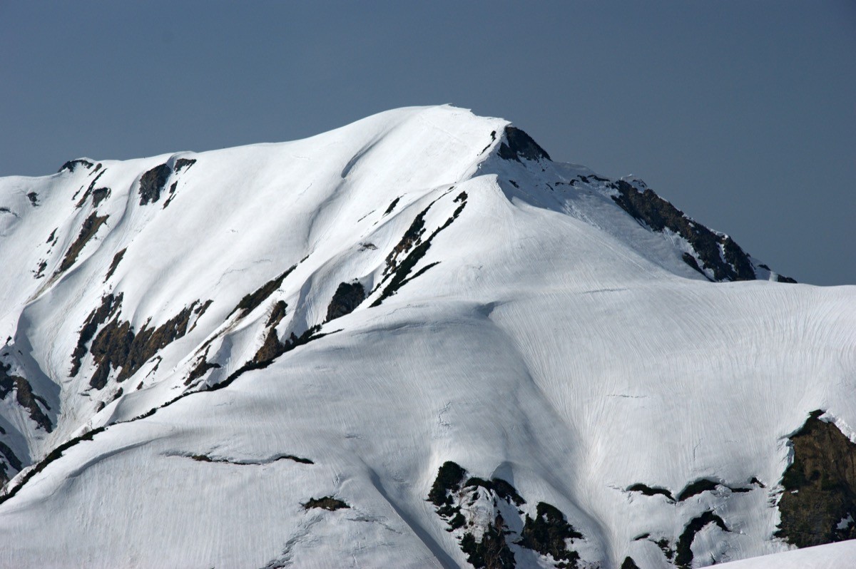
Mt. Oku-Dainichi (奥大日岳, 2,611 m), straddling Tateyama and Kamiichi towns in Toyama Prefecture, is one of the 200 Famous Japanese Mountains.
It stands in the Dainichi range of the Hida Mountains (Northern Alps) and is known as the finest viewpoint of Mt. Tsurugi, which rises directly ahead. The round trip from Murodo via Raichozawa to the summit is an intermediate route of about 7 hours, around 12 km, with about 550 m of ascent — and is a day trip if you use the Tateyama Kurobe Alpine Route.
The nearest station is Tateyama on the Toyama Chiho Railway. You reach Murodo by the vehicles of the Tateyama Kurobe Alpine Route.
The trailhead is Murodo (elevation 2,450 m). The route runs Murodo → Raichozawa → Shin-Murodo-norikoshi → Mt. Oku-Dainichi and back; once on the ridge, Mt. Tsurugi spreads out ahead, and alpine flowers such as chinguruma and Hakusan-ichige are abundant.
The standard round trip is about 7 hours. It is a relatively approachable intermediate climb from Murodo, but the ridge is windy, and you must watch for sudden weather changes and late-lying snow. The season is early July to early October. Around Murodo are huts such as the Raichozawa Hutte and Mikurigaike Onsen, so staying overnight at Murodo or Raichozawa lets you start early. The area is home to rock ptarmigans.
How to access the trailheads
1. [Round trip] Tateyama Station → Murodo (Mt. Oku-Dainichi trailhead)
From the Toyama side, take the Toyama Chiho Railway Tateyama Line from Dentetsu-Toyama to Tateyama Station (about 65 minutes). From Tateyama you transfer to the Tateyama Kurobe Alpine Route.
From Tateyama Station take the Tateyama Cable Car to Bijodaira (about 7 minutes), then change to the Tateyama Highland Bus to Murodo (about 50 minutes). The cable car connects about every 20 minutes and the bus about every 30 minutes; the one-way fare from Tateyama to Murodo is about 4,090 yen (cable car 1,090 yen + highland bus 3,000 yen, with the Toyama railway separate).
The 2026 season runs from April 15 to November 3. The first cable car from Tateyama Station is around 6:40 at the peak season (usually around 7:00), and the last descending service from Murodo is around 16:20. On the first service you reach Murodo by around 8 a.m., so even a 7-hour round trip lets you descend before 4 p.m. as a day trip — but always confirm the latest times and fares officially.
– Tateyama Kurobe Alpine Route Information 076-481-1500
Source: [Tateyama Kurobe Alpine Route timetable] / [Fares and tickets]
Route and safety notes
Route: Murodo → Raichozawa → Shin-Murodo-norikoshi → Mt. Oku-Dainichi. The standard round trip is about 7 hours, around 12 km, with about 550 m of ascent, an intermediate route. Past the Raichozawa campground and up to Shin-Murodo-norikoshi, Mt. Tsurugi opens up directly ahead.
Day-trip guide: a day trip is possible if you ride the first service to Murodo, but an overnight at Murodo or Raichozawa gives more leeway. Huts such as the Raichozawa Hutte and Mikurigaike Onsen are available.
Weather and snow: the ridge is windy and the weather changes quickly. Snow lingers late in places, and the season is early July to early October.
Gear: carry water, food, rain gear and warm clothing, and submit a climbing plan. There are toilets at Murodo and the Raichozawa Hutte.
In an emergency: call 110 (police) or 119 (fire/rescue).
・Tateyama Kurobe Alpine Route Information 076-481-1500
Photo by 663highland / Wikimedia Commons, CC BY-SA 3.0
Comments