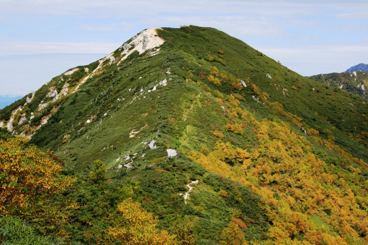
Mt. Kosumo (越百山, 2,613 m), straddling Ōkuwa in Kiso District and Iijima in Kamiina District in Nagano, is one of the 300 Famous Japanese Mountains and a main peak of the southern Kiso Range (Central Alps).
Its unusual name “Kosumo” and the quiet ridge of creeping pine and white gravel at the treeline are its charm; it is a viewpoint at the southern end of the Central Alps, on the way to Mt. Utsugi and Mt. Minamikoma. The usual route starts at the Inagawa Dam and tops out via the Kosumo Hut, but it is a long day for fit hikers. Public transport is sparse, so you reach the Inagawa-side trailhead from JR Suhara Station by taxi.
The trailhead is the one above the Inagawa Dam (Ōkuwa Village; about 1,090 m elevation); from here you climb via Fukutochi Bridge and the Kosumo trailhead to Shimo-no-Koru and the Kosumo Hut (2,340 m), then follow the ridge to Mt. Kosumo. However, the Inagawa forest road has remained closed to vehicles up to the car park above the dam since the 2018 storm disaster, so at present you walk from about 1 km below the dam to the trailhead — about an hour more on the forest road than the standard time.
The Kosumo Hut on the ridge is currently closed, but the adjacent Kosumo emergency hut is open. As the day is long, plan an early-start day trip or a night at the emergency hut. There are two water points on the trail. The season is July to October; this is bear country, so carry a bear bell. Check the latest forest-road and trail conditions with Ōkuwa Village.
How to access the trailhead
1. [Round trip] Suhara Station ⇄ Inagawa Dam (trailhead, by taxi)
The base is JR Chūō Main Line (Chūō-Saisen) Suhara Station; as there is no bus toward the Inagawa-side trailhead, use a taxi from the station. From Suhara Station to the Inagawa Dam area is roughly 6,000 yen by taxi. No taxi waits at Suhara Station, so reservation is essential (Nagiso Kankō Taxi tel 0264-55-4155).
① Note the forest-road closure: the Inagawa forest road has been closed to vehicles up to the trailhead car park above the dam since the 2018 storm disaster. Often even taxis can only reach about 1 km below the dam, from where it is about an hour on foot to the trailhead (about 1,090 m). Confirm how far the taxi can go when you book.
② Forest-road and trail check: confirm closure status, bears and toilets in advance (Ōkuwa Village Office tel 0264-55-3080).
③ By car: likewise you cannot reach the trailhead car park, only the last drivable point below the dam (roadside parking is not allowed because of work traffic). About 1 hour from the Nakatsugawa IC on the Chūō Expressway.
Reference: [Ōkuwa Village — Central Alps climbing notices]
Route and safety notes
Route: Inagawa Dam trailhead → Fukutochi Bridge → Kosumo trailhead → Shimo-no-Koru → Kosumo Hut (2,340 m) → Mt. Kosumo (2,613 m) and back. Measured from the dam gate the standard time is about 12 hours, about 17–18 km with roughly 1,900 m of cumulative gain — long, for fit hikers. Plan an early-start day trip or a one-night, two-day trip staying at the Kosumo emergency hut.
Access and taxi: from Suhara Station take a taxi toward the Inagawa Dam (about 6,000 yen, by reservation; Nagiso Kankō Taxi tel 0264-55-4155). Because the forest road is closed, a walk to the trailhead is added.
Huts: the Kosumo Hut on the ridge is closed; the adjacent Kosumo emergency hut is available. Carry plenty of water and check the two water points on the trail.
Ridge and route-finding: the ridge above the treeline is exposed to wind, rain, lightning and cold. The path toward Minami-Kosumo is faint in creeping pine and not for general hikers. Carry a map and compass (GPS).
Season and gear: the season is July to October. Carry rain gear, warm clothing, a headlamp and ample food, and a bear bell as this is bear country.
In an emergency: call 110 (police) or 119 (fire/rescue).
・Ōkuwa Village Office 0264-55-3080 / Kiso Police Station 0264-22-0110
Photo by Alpsdake / Wikimedia Commons, CC BY-SA 3.0

Comments