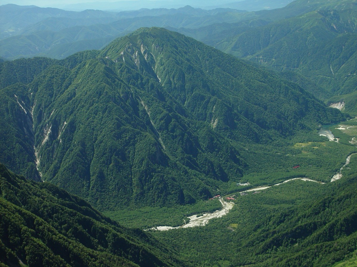
Mt. Kasumizawa (霞沢岳, 2,646 m) in Matsumoto, Nagano Prefecture, is one of the 200 Famous Japanese Mountains.
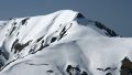
It lies in the southern Hida Mountains (Northern Alps) and is known for its sweeping view, looking down on Kamikochi and across to the Hotaka range and Mt. Yari. The route from Kamikochi over Tokugo Pass to the summit is long — about 13.5 hours and 22 km round trip in standard time — so a two-day trip staying at the Tokugo-toge hut is usual.
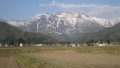
The nearest station is JR Matsumoto. You access Kamikochi by the Alpico Kamikochi Line and bus.
The trailhead is the Kamikochi Bus Terminal. The route runs Kamikochi → Myojin → Tokugo Pass → Junction Peak → K1 Peak → Mt. Kasumizawa and back, rated fitness level 5 and technical grade C in the Shinshu mountain grading, for fit hikers. Beyond Tokugo Pass it is a long ridge of narrow sections and repeated ups and downs.
A two-day trip — day 1 from Kamikochi to Tokugo Pass (overnight at the Tokugo-toge hut), day 2 to the summit and back down to Kamikochi — is the safe option. The Tokugo-toge hut is a Registered Tangible Cultural Property, open mid-July to mid-October, with reservations required for both the hut and the campsite. The season is July to October. The area is home to Asian black bears, so take precautions such as a bear bell.
How to access the trailheads
1. [Round trip] Shin-Shimashima Station → Kamikochi (Mt. Kasumizawa trailhead)
From JR Matsumoto Station, take the Alpico Kamikochi Line (train) to the terminus, Shin-Shimashima Station (about 30 minutes), then continue by Alpico bus to the Kamikochi Bus Terminal (about 1 hour). Since private cars are restricted at Kamikochi, public transport is convenient.
In 2026 the bus to Kamikochi runs April 17 to November 15 under a reservation-priority system. From Shin-Shimashima the first departure is 7:10 and the last is 15:30; the last departure from Kamikochi is around 17:55 (check the latest times and fares with Alpico). For a two-day trip, the Tokugo-toge hut requires advance reservation.
– Alpico Shin-Shimashima Office 0263-92-2511
Source: [Alpico, Kamikochi Line] / [Tokugo-toge hut, Mt. Kasumizawa]
Route and safety notes
Route: Kamikochi → Myojin → Tokugo Pass → Junction Peak → K1 Peak → Mt. Kasumizawa. The standard round trip is about 13.5 hours and about 22 km, for fit hikers (fitness level 5, technical grade C). Beyond Tokugo Pass there are narrow ridges and repeated ups and downs.
Two days recommended: a day trip means far too many hours on the move, so an overnight at the Tokugo-toge hut is safer. Both the hut and the campsite require reservations, and the open season is mid-July to mid-October.
Bears: the area is home to Asian black bears. Take precautions such as a bear bell and avoid going alone.
Gear and season: the season is July to October. Carry water, food and rain gear, and submit a climbing plan.
In an emergency: call 110 (police) or 119 (fire/rescue).
・Alpico Shin-Shimashima Office 0263-92-2511
Photo by Alpsdake / Wikimedia Commons, CC BY-SA 4.0
Comments