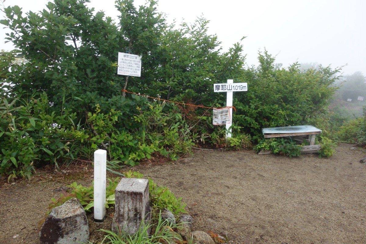
Mount Maya (Mayasan, 1,020 m) is a mountain in Tsuruoka City, Yamagata, and is one of Japan’s 300 Famous Mountains.
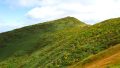
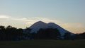
A fine peak in the north-western Asahi Mountains, its appeal lies in its old-growth beech forest, rocky ridge trails and the wide views from the summit of Mount Gassan, Mount Chōkai and Sado Island floating in the Sea of Japan. There is the Kurasawa trailhead on the Asahi side and the Koshisawa and Sekikawa trailheads on the Atsumi side, each an intermediate route of about 2 hours 30 minutes to 3 hours one way to the summit.
Public transport to the trailheads is limited, so you reach them by combining a taxi from JR Atsumi-Onsen or Tsuruoka Station.
The main trailheads are Kurasawa (Asahi area) and Koshisawa and Sekikawa (Atsumi area), all with parking. The main route is an out-and-back from each trailhead to the summit (1,020 m), an intermediate route of about 2 hours 30 minutes to 3 hours one way. The summit consists of three peaks — Mae-no-yama, Naka-no-yama and Minami-no-yama — with wide views of Mount Gassan, Mount Chōkai and Sado Island.
The best season is from the late-May trail opening to the late-October closing; after closing, the chains, ladders and signs are removed, and the path toward Nanatsu-daki Falls on the Koshisawa and Sekikawa sides is closed. Always check the latest trail conditions and arrange a taxi before you go.
*Last checked: June 7, 2026
How to access the trailheads
1. [There & Back] Atsumi-Onsen / Tsuruoka Station ⇄ the trailheads (bus + taxi)
Atsumi-Onsen Station and Tsuruoka Station on the JR Uetsu Main Line are your bases. There is no direct bus to Mount Maya, so combine a taxi from the nearest station.
① Atsumi side: Atsumi-Onsen Station → Koshisawa / Sekikawa trailhead (taxi)
Atsumi-Onsen Station on the JR Uetsu Main Line is the base. The Koshisawa and Sekikawa trailheads are along National Route 345, so take a taxi from Atsumi-Onsen Station.
— Atsumi Onsen Kanko Jidosha 0235-43-2330 / Atsumi Tourism Association 0235-43-3547.
② Asahi side: Tsuruoka Station → Kurasawa trailhead (bus + taxi)
From Tsuruoka Station (S-Mall Bus Terminal), take the Shonai Kotsu “Ochiai Line” toward the Asahi area. The buses are very infrequent, so check the times in advance. The Kurasawa trailhead is about 4.5 km beyond the village, so a taxi transfer from the Asahi area is reliable.
— Asahi-area taxi 0235-53-2121 / Shonai Kotsu (Tsuruoka) 0235-24-5333.
③ Note (closures and season): on the Koshisawa and Sekikawa routes, the path leading to Nanatsu-daki Falls is closed because safety cannot be assured. There may be fallen trees, and after the closing day (late October) the chains, ladders and signs are removed.
By car: each trailhead has parking. It is about 40–45 minutes from the Tsuruoka IC on the Yamagata Expressway via National Route 345 to the Atsumi side.
References: [Atsumi Tourism Association: Mount Maya] / [Tsuruoka City: Mount Maya (Kurasawa) hiking info]
Trail Guide and Safety Notes
Route: the main routes are out-and-back from the Kurasawa, Koshisawa or Sekikawa trailheads to the summit (1,020 m), each an intermediate route of about 2 hours 30 minutes to 3 hours one way. They follow streams to the ridge, with rocky sections and ladders in the upper part making for a varied climb.
Rock and weather: the upper section has continuous rocky ridges, ladders and chained passages, so beware of slips and rockfall. As the safety gear is removed after closing, climb within the open season. The summit area is windy and can be socked in by mist. It is Asian black bear country.
Views and nature: from the summit there is a panorama of Mount Gassan, Mount Chōkai, the Asahi range and Sado Island floating in the Sea of Japan. The western slope has old-growth beech forest and stands of Kuril bamboo, and the fresh green and autumn colours are lovely.
Equipment and emergencies: carry rain gear, warm clothing, a headlamp, a map/GPS, plenty of food and a bear bell. In an accident or emergency call 110 (police) or 119 (fire/ambulance).
・Tsuruoka Police Station 0235-22-0110
Photo by Koda6029 / Wikimedia Commons, CC BY-SA 4.0
Comments