
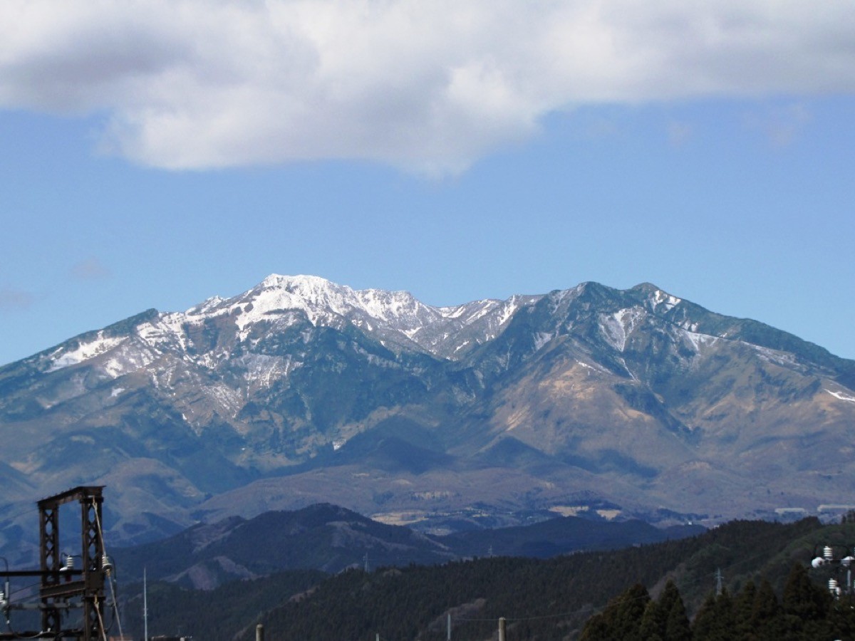
Mt. Nyoho (女峰山, 2,483 m) in Nikko, Tochigi Prefecture, is a stratovolcano and one of the 200 Famous Japanese Mountains.
Together with Mt. Nantai and Mt. Taro it is one of the Three Mountains of Nikko, and the inner shrine of the Nikko Futarasan Shrine is enshrined at its summit. The standard route from Kirifuri Kogen over Mt. Akanagi to the summit is a fit-hiker course of about 9–10 hours round trip.
The nearest station is Nikko on the Tobu Nikko Line and JR Nikko Line. From there you reach the Kirifuri Kogen trailhead by Tobu bus (running April–November).
The trailhead is Kirifuri Kogen (Kisugedaira, about 1,345 m elevation), where a 1,445-step stairway called the “Sky Corridor” leads from the bus stop up to Komaruyama. The route runs Kirifuri Kogen → Komaruyama → Mt. Akanagi → Okusha-ato → Ichigasone → Mt. Nyoho summit and back, about 1,100 m of elevation gain, about 6.5 km one way, about 9–10 hours round trip, intermediate-to-advanced. It is a long day with narrow ridges and rocky sections.
At Kisugedaira, day lilies (Nikko-kisuge) bloom from late June to early July. The season is May to October (buses run April–November). The area is home to Asian black bears, so take precautions such as a bear bell, and prepare ample water and food.
How to access the trailheads
- [Outbound] Nikko Station → Kirifuri Kogen (Mt. Nyoho trailhead)
- [Return] Kirifuri Kogen (Mt. Nyoho trailhead) → Nikko Station
1. [Outbound] Nikko Station → Kirifuri Kogen (Mt. Nyoho trailhead)
From Nikko Station on the Tobu Nikko Line and JR Nikko Line, take the Tobu bus bound for Kirifuri Kogen (or Ozasa Bokujo) and get off at Kirifuri Kogen (about 27 minutes, fare ¥850, running April–November).
Note: Mt. Nyoho is a long round trip of about 9–10 hours, and even on the first bus (Tobu-Nikko 8:57 departure, Kirifuri Kogen 9:24 arrival) it is hard to climb to the summit and back in time for the last return bus (Kirifuri Kogen 16:05). It is safer to stay overnight in Nikko or at Kirifuri Kogen and start early. To start at dawn, you can also take a taxi from Nikko Station (about 20 minutes to Kirifuri Kogen).
– Nikko Kotsu (taxi) 0288-54-1188
| Dep. Tobu-Nikko Station | Arr. Kirifuri Kogen |
|---|---|
| 08:57 | 09:24 |
| 10:24 | 10:51 |
| 13:02 | 13:29 |
| 14:34 | 15:01 |
| 15:10 | 15:37 |
Source: [Tobu Bus On-Line, Nikko area] / [NAVITIME, Kirifuri Kogen Line]
2. [Return] Kirifuri Kogen (Mt. Nyoho trailhead) → Nikko Station
After the descent, return from Kirifuri Kogen by Tobu bus (toward Nikko Station; about 27 minutes, fare ¥850). The last departure from Kirifuri Kogen is 16:05, so plan to catch it; if you cannot, arrange a taxi.
– Nikko Kotsu (taxi) 0288-54-1188
| Dep. Kirifuri Kogen | Arr. Tobu-Nikko Station |
|---|---|
| 09:52 | 10:19 |
| 11:19 | 11:46 |
| 13:57 | 14:24 |
| 15:29 | 15:56 |
| 16:05 | 16:32 |
Source: [Tobu Bus On-Line, Nikko area]
Route and safety notes
Route: Kirifuri Kogen (Kisugedaira) → Komaruyama → Mt. Akanagi → Okusha-ato → Ichigasone → Mt. Nyoho summit. About 9–10 hours of walking round trip with about 1,100 m of elevation gain, intermediate-to-advanced. There are narrow ridges, rocky sections and scree, so allow plenty of time and energy.
Coping with the long day: a day trip is tight on time, so staying overnight is recommended. Start early, carry a headlamp and map, and be ready to turn back rather than push on.
Bears: the area is home to Asian black bears. Take precautions such as a bear bell and avoid going alone.
Gear and season: the season is May to October (buses run April–November). Water is scarce, so carry plenty, along with food and rain gear, and submit a climbing plan.
In an emergency: call 110 (police) or 119 (fire/rescue).
・Nikko Kotsu (pick-up / descent contact) 0288-54-1188
Photo by 駅弁 / Wikimedia Commons, CC BY 3.0
Comments