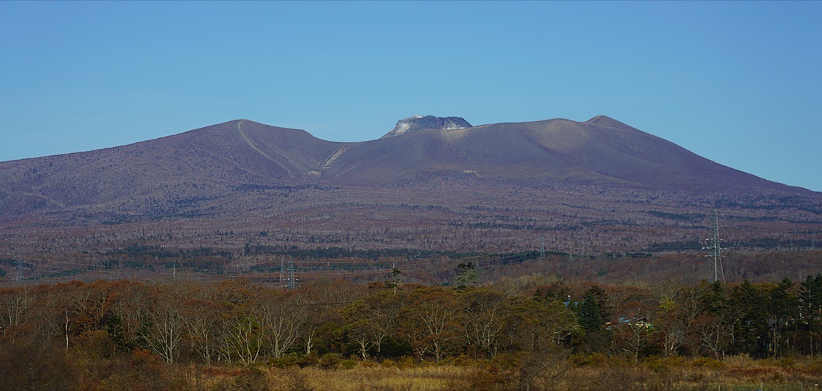
Mt. Tarumae (樽前山, 1,041 m), straddling Tomakomai and Chitose in Hokkaido, is an active volcano and one of the 200 Famous Japanese Mountains.
Rising south of Lake Shikotsu, its appeal is the lava dome swelling up on the crater floor and the view of Lake Shikotsu and the Pacific from the crater rim. The route around the crater rim from the 7th-station hut is a beginner-level round trip of about 3 hours, letting even beginners feel the power of an active volcano.
The nearest station is JR Tomakomai. There is no public bus, so you reach the 7th-station hut by taxi from Tomakomai Station.
The trailhead is the 7th-station hut (emergency shelter with toilet). The route runs 7th-station hut → west end of the crater rim → Higashiyama → around the rim → 7th-station hut; the standard round trip is about 3 hours with about 520 m of ascent, beginner level. From the parking, about 50 minutes past the tree line brings you to the crater rim, with the lava dome close at hand.
Mt. Tarumae is an active volcano, and the inside of the crater rim, including the highest point (the Tarumae dome), is off-limits. You may go only as far as the crater rim and Higashiyama (1,022 m); if you smell volcanic gas or notice anything unusual, descend at once. Always check the volcanic alert level before climbing. There is no water source, so bring your own. The season is early June to late October.
How to access the trailheads
1. [Round trip] Tomakomai Station → 7th-station hut (Mt. Tarumae trailhead)
Tomakomai Station on the JR Muroran and Chitose lines is the gateway. The 7th-station hut is about 50 minutes by taxi from Tomakomai Station. There is parking for about 30 cars in front of the hut.
There is no route bus to the trailhead, so access is basically by taxi or rental car. Since the taxi ride is long, reserve both ways in advance; arranging a pickup for your descent time is reassuring. It is also about 1 hour by car from New Chitose Airport.
– Tomakomai Daiichi Kanko Hire 0144-74-3131
Source: [Tomakomai City, partial climbing restrictions on Mt. Tarumae] / [JMA, volcanic activity of Mt. Tarumae]
Route and safety notes
Route: 7th-station hut → west end of the crater rim → Higashiyama → around the rim → 7th-station hut. The standard round trip is about 3 hours, around 6 km, with about 520 m of ascent, beginner level. From the crater rim you take in Lake Shikotsu and the Pacific.
Active-volcano restrictions: the inside of the crater rim, including the lava dome, is off-limits, and you may go only as far as the crater rim and Higashiyama. Volcanic gas can drift depending on the wind, so if you smell it or notice anything unusual, descend at once. Considering evacuation in an emergency, avoid climbing in large groups. Always check the volcanic alert level before climbing.
Gear and season: the season is early June to late October. There is no water source, so bring your own, and do not push on in strong wind, as the crater rim is dangerous then.
In an emergency: call 110 (police) or 119 (fire/rescue).
・Tomakomai Police Station 0144-35-0110
Photo by Ray Swi-hymn / Wikimedia Commons, CC BY-SA 2.0
Comments