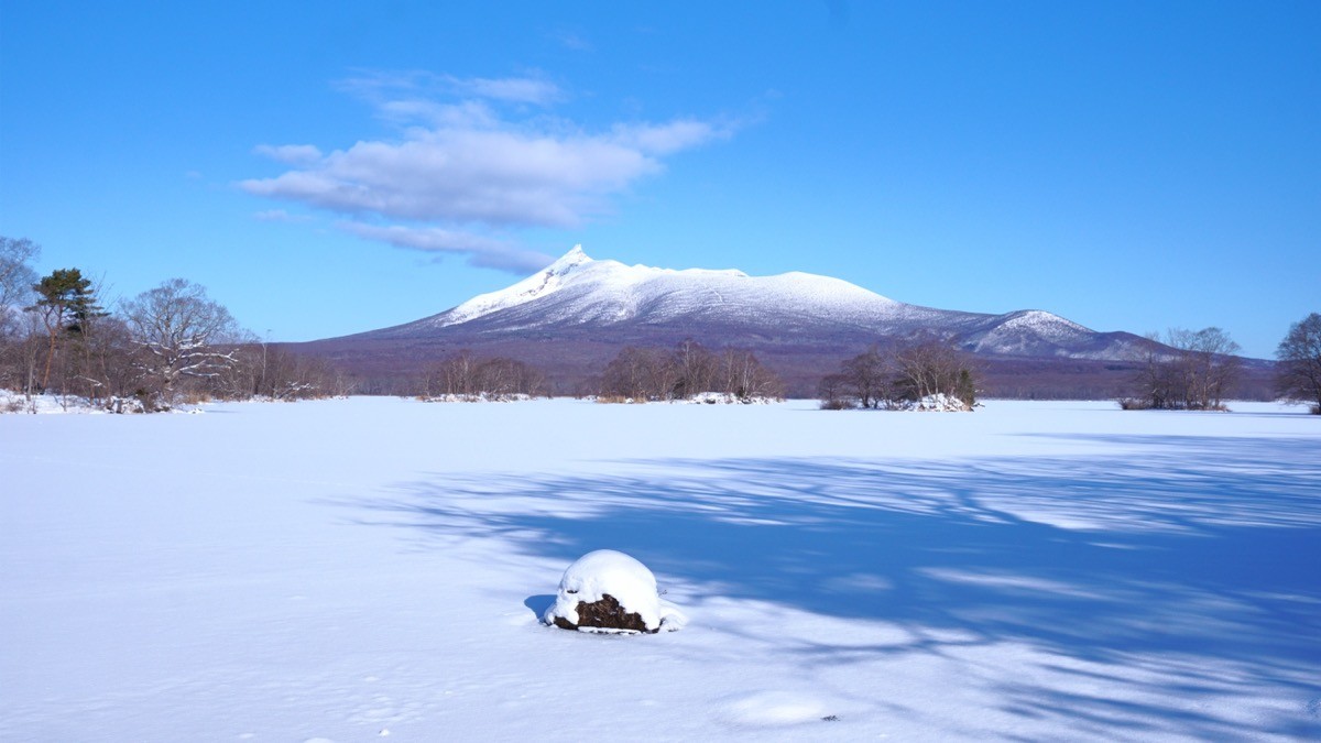
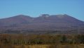
Mt. Hokkaido-Komagatake (北海道駒ヶ岳, 1,131 m), straddling Mori, Shikabe and Nanae in Hokkaido, is an active volcano and one of the 200 Famous Japanese Mountains.
With Lake Onuma and Lake Konuma at its foot, it is the symbol of Onuma Quasi-National Park, one of Japan’s “Three New Views,” and its sharp Kengamine peak is striking. As an active volcano the area around the crater is restricted, and at present the climbable section is the round trip of about 3 hours from the Akaigawa trail to Umanose (about 900 m).
The nearest station is Onuma-Koen on the JR Hakodate Main Line. From Onuma-Koen you reach the Akaigawa trailhead by taxi.
The trailhead is the Akaigawa trailhead (6th-station parking). The route is the round trip from the 6th-station parking to Umanose; the standard round trip is about 3 hours, beginner level. On the volcanic-gravel path you look down on Lake Onuma and Lake Konuma, and on a clear day as far as Hakodate.
As an active volcano, only the Akaigawa trail is open, and the end point is Umanose. The highest point Kengamine and Sunahara-dake are off-limits. Climbing is usually allowed from June 1 to October 31, 9:00 to 15:00, and a climbing notification must be submitted (always check the latest official dates and times from Mori Town for 2026). There is a toilet at the 6th-station parking.
How to access the trailheads
1. [Round trip] Onuma-Koen Station → Akaigawa trailhead (Mt. Hokkaido-Komagatake trailhead)
From the Hakodate side, take the JR Hakodate Main Line to Onuma-Koen Station. The Akaigawa trailhead (6th-station parking) is about 30 minutes by taxi from Onuma-Koen Station (around 3,500 yen).
There is no route bus to the trailhead, so a taxi is the norm. Taxis in Onuma Quasi-National Park are few, so reserve both ways in advance; since climbing hours are fixed, telling them your pickup time is reassuring. You can also walk about 7 km (about 2.5 hours) from Akaigawa Station (unstaffed) to the trailhead, but no taxis wait there.
– Karamatsu Hire (Onuma) 0138-67-1010
– Onuma International Exchange Plaza (climbing information) 0138-67-2170
Source: [Hokkaido Regional Forest Office, climbing restrictions] / [Mori Town, restriction easing]
Route and safety notes
Route: Akaigawa trailhead (6th-station parking) → Umanose. The standard round trip is about 3 hours, beginner level. The volcanic-gravel path is easy to walk, but with the open views it can be windy on some days.
Active-volcano restrictions: the area around the crater is restricted, only the Akaigawa trail is open, and the end point is Umanose. You cannot go on to Kengamine or Sunahara-dake. Climbing is usually allowed from June 1 to October 31, 9:00 to 15:00, and a climbing notification must be submitted. Restrictions change with volcanic activity, so always check the latest information.
Gear and season: the climbing season is June to October. Carry water, food, rain gear and warm clothing.
In an emergency: call 110 (police) or 119 (fire/rescue). For volcano and restriction inquiries, contact the Mori Town disaster-prevention section.
・Mori Town Disaster Prevention & Transport Section 01374-2-2181
Photo by 掬茶 / Wikimedia Commons, CC BY-SA 4.0
Comments