
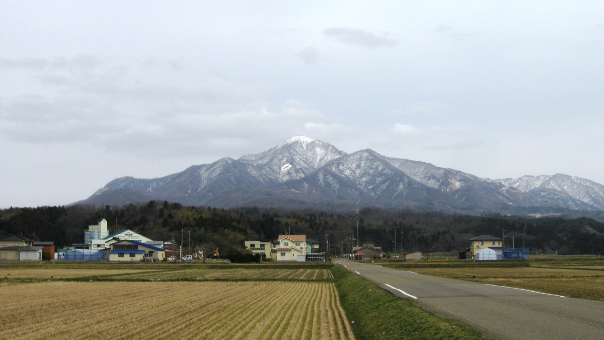
Mount Yoneyama (Yoneyama, 992 m) sits on the border of Kashiwazaki City and Jōetsu City in Niigata Prefecture, and is one of Japan’s 300 Famous Mountains.
An isolated peak that juts out toward the Sea of Japan, its appeal lies in the wide views of the Sea of Japan, Sado Island, the Myōkō range and the Yoneyama plain from the summit, and its long history of faith (Yoneyama Yakushi). The usual day hike starts from Yoneyama or Kakizaki Station on the Shin’etsu Main Line and goes up to the summit and back via routes such as the Ōdaira course.
For public-transport access, take a taxi from Yoneyama or Kakizaki Station on the Shin’etsu Main Line to each trailhead.
The trailhead is the Ōdaira trailhead (about 200 m, on the Kashiwazaki side), while the Shimomaki course has a rest facility, “Shimomaki Base 993”. The main route is Ōdaira trailhead → Peak 711 → Mount Yoneyama (992 m) and back, an intermediate route with a standard time of about 4–5 hours. At the summit there are the Yoneyama Yakushi hall and an emergency hut, with wide views of the Sea of Japan, Sado and the Myōkō range.
The best season is spring to late autumn (May–November) outside the snow season; there is snow in winter. Always check the latest trail and forest-road conditions and arrange a taxi before you go.
*Last checked: June 6, 2026
How to access the trailheads
1. [There & Back] Yoneyama / Kakizaki Station ⇄ the trailheads (taxi)
Yoneyama Station and Kakizaki Station on the JR Shin’etsu Main Line are your bases. As there are no scheduled buses to the trailheads, take a taxi from the station.
① Yoneyama Station → Ōdaira trailhead (taxi)
For the Ōdaira course on the Kashiwazaki side, take a taxi from Yoneyama Station to the Ōdaira trailhead. The Ōdaira course is the most popular main route.
② Kakizaki Station → Shimomaki trailhead (taxi)
For the Shimomaki course on the Jōetsu side, take a taxi from Kakizaki Station to the Shimomaki trailhead (Shimomaki Base 993).
③ Taxi company
As there are no scheduled buses to the trailheads, booking a taxi in advance is reliable.
— Kashiwazaki Kotsu (Hakutaku) 0257-21-0061
④ Return: it is reassuring to book a taxi back to the trailhead for your expected descent time. Afterwards return to Yoneyama or Kakizaki Station.
By car: there is parking at the Ōdaira and Shimomaki trailheads. It is 20–30 minutes from the Kakizaki IC on the Hokuriku Expressway to the trailheads.
References: [Niigata Tourism Navi: Yoneyama] / [Kashiwazaki City: Yoneyama]
Trail Guide and Safety Notes
Route: the main route is Ōdaira trailhead → Peak 711 → Mount Yoneyama (992 m) and back. The standard time is about 4–5 hours, an intermediate route. There are several trailheads — Shimomaki, Tanine, Noda and Yoshio — each reaching the summit in around 3 hours. At the summit there are the Yoneyama Yakushi hall and a log-cabin-style emergency hut.
Steep slopes and route-finding: there are steep slopes just below the summit that get slippery after rain. Follow the signs and take care not to mistake your descent route at the junctions of the several courses (returning by the same course you came up is safest).
Views and seasons: the summit gives wide views of the Sea of Japan, Sado Island and the Myōkō range. Fresh greenery in spring and autumn colours are lovely, and the sea breeze keeps it relatively cool even in summer. There is snow in winter, and snow gear is needed in the late-snow season.
Equipment and emergencies: carry rain gear, warm clothing, a headlamp, a map/GPS and plenty of food and water. In an accident or emergency call 110 (police) or 119 (fire/ambulance).
・Kashiwazaki Police Station 0257-21-0110
Photo by shin115 / Wikimedia Commons, CC BY-SA 3.0

Comments