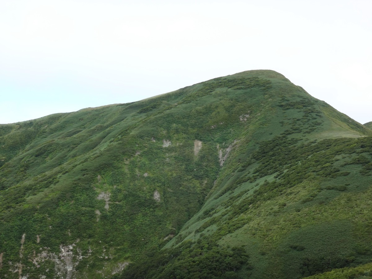
Mt. Waga (和賀岳, 1,439 m), on the border of Daisen (Akita) and Nishiwaga (Iwate), is one of the 200 Famous Japanese Mountains.
The main peak of the Mahiru range, it is known as one of the “100 Famous Flower Mountains,” its ridge turning yellow in summer with fields of Nikko day-lilies. Following the long ridge from Mt. Yakushi, it is a view-rich stamina-focused intermediate mountain (for the fit).
There is no public transport to the trailhead, so a taxi from the nearest station is the norm. The nearest station is Omagari on the JR Akita Shinkansen and Ou Main Line. You reach the Kanrosui trailhead by taxi from Omagari Station.
The trailhead is the Kanrosui trailhead (the Mt. Yakushi / Mt. Waga trailhead, about 369 m). The standard route is an out-and-back: Kanrosui trailhead → Mt. Yakushi → Kowashikura → Mt. Waga, with a standard time of about 9 to 10 hours round trip, a long, stamina-focused intermediate course (for the fit). You climb through beech forest to Mt. Yakushi, then go up and down the flower-field ridge to Mt. Waga.
There is an emergency hut near Mt. Yakushi along the way, a rest point and refuge on this long course. The season runs from early summer, when the flower fields are at their best, to autumn foliage (roughly June to October). As a day trip is long, an early start and a night before are reassuring. Always check the latest trail and forest-road conditions in advance.
How to access the trailheads
1. [Round trip] Omagari Station → Kanrosui trailhead
Take the Akita Shinkansen or the Ou Main Line to Omagari Station. There is no local bus to the Kanrosui trailhead, so a taxi is the standard option.
To the trailhead is about 50 minutes by taxi from Omagari Station (via National Route 105 and Prefectural Road 50, with about 6 km of unpaved forest road near the trailhead). The forest road is rough, and vehicle access may be restricted depending on conditions. No taxis wait at the trailhead and mobile phone reception is poor, so booking both the outbound and return rides in advance is essential. As the round trip is a long 9 to 10 hours, allow margin in the descent time you give for the pickup.
– Omagari Taxi 0187-62-0050
– San Taxi (Daisen) 0187-62-3141
Forest road / overnight stay: For forest-road and trail conditions, check in advance with Daisen City (Kyowa area) or the Nishiwaga Tourism Association. For a night before, lodgings around Omagari are convenient. If you drive, there is free parking for about 10 cars and a toilet at Kanrosui.
Source: [Akita Forest Support Center, Mt. Waga] / [Nishiwaga Tourism Association, climbing guide]
Route and safety notes
Route: Kanrosui trailhead → Buna-dai → Takikura → Kurakata → Mt. Yakushi → Kowashikura → Mt. Waga (1,439 m), out and back. The standard time is about 9 to 10 hours round trip, a long, stamina-focused intermediate course (for the fit). There is an emergency hut near Mt. Yakushi. The ridge before Mt. Waga turns into fields of Nikko day-lilies in summer.
Long day and water: The route is long and there is little water on the ridge, so carry plenty of water and start early with margin to spare. The flower-field ridge is fully exposed, so beware of strong wind, lightning, and fog.
Forest road and access: The forest road before the trailhead is unpaved and rough, and can be impassable after heavy rain or in the snow season. Check the weather and road conditions not only for the day but for the preceding several days.
Gear and season: The season runs June to October. For the long route, carry water, food, rain gear, warm clothing, a headlamp, and a map/GPS.
Emergencies: In case of accident or distress, call 110 (police) or 119 (fire/rescue).
・Daisen City Hall 0187-63-1111
Photo by Koda6029 / Wikimedia Commons, CC BY-SA 4.0
Comments