
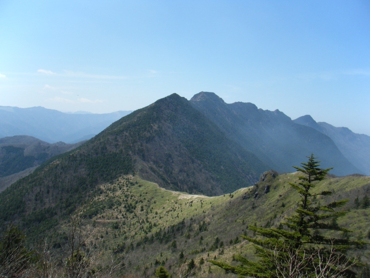
Mt. Higashiakaishi (東赤石山, 1,706 m), straddling Niihama City and Shikokuchūō City in Ehime Prefecture, is one of the 200 Famous Japanese Mountains.
It lies in the eastern Hōō Range of the Shikoku Mountains, and its summit area is a ridge of reddish-brown peridotite rock where endemic alpine plants such as Adenophora and Rosa nipponica bloom in July. The standard route from Ikadazu (or Seba) to the summit and back takes about 7 hours round trip, intermediate-to-advanced, a full day for fit hikers.
The nearest station is Niihama on the JR Yosan Line. From there you reach the Ikadazu trailhead by the Besshiyama community bus.
The trailheads are Ikadazu (about 640 m elevation) and Seba, about 500 m to its east, both within the free-boarding zone of the Besshiyama community bus. The route runs Seba (Ikadazu) → Seba valley → Akaishi-goe (junction) → Mt. Higashiakaishi (1,706 m) and back, about 7 hours round trip with about 1,070 m of elevation gain, intermediate-to-advanced. Peridotite outcrops are scattered along the way, and the section just below the summit is rocky-ridge walking.
There is the Akaishi-sansō hut on the ridge, but check its operating status in advance. The season is May to November (alpine flowers in July). In the area, watch out for pit vipers and leeches rather than bears. There are no shops on the mountain, so prepare water and food.
How to access the trailheads
- [Outbound] Niihama Station → Ikadazu (Mt. Higashiakaishi trailhead)
- [Return] Ikadazu (Mt. Higashiakaishi trailhead) → Niihama Station
1. [Outbound] Niihama Station → Ikadazu (Mt. Higashiakaishi trailhead)
From in front of Niihama Station on the JR Yosan Line, take the Niihama City Besshiyama community bus (bound for Besshibashi) and get off at Ikadazu (fare ¥400, reservations given priority). Ikadazu and Seba are in the free-boarding zone, so tell the driver to stop.
Note: Mt. Higashiakaishi is a long round trip of about 7 hours, and even on the first bus (arriving Ikadazu 10:12), making a same-day return bus after the climb is only possible on days when the seasonal bus (departing 17:13) runs. On other days, even with an early start the return bus is at 13:48 (too early), so staying overnight (Besshiyama Onsen Yuragi-no-Mori) or taking a taxi is the realistic option. Confirm reservations and operation with the Besshiyama branch office (weekdays) or the taxi company.
– Besshiyama Branch Office 0897-64-2011 (weekdays 8:30–17:15) / Hikari Taxi 0897-43-7563 (evenings, weekends)
| Dep. Niihama Station | Arr. Ikadazu |
|---|---|
| 9:06 | 10:12 |
| 13:06 | 14:12 |
| 16:06 | 17:12 |
| 18:06 | 19:12 |
Source: [Niihama City, Besshiyama community bus timetable] / [Tozanguchi.net, Ikadazu]
2. [Return] Ikadazu (Mt. Higashiakaishi trailhead) → Niihama Station
After the descent, return from Ikadazu on the Besshiyama community bus (toward Niihama; fare ¥400, reservations given priority). The last bus that gets you back the same day is the 17:13 departure in the seasonal-bus periods; on other days the 13:48 departure is effectively the last. If your descent runs late, arrange a taxi.
– Hikari Taxi 0897-43-7563
| Dep. Ikadazu | Arr. Niihama Station |
|---|---|
| 6:58 | 8:05 |
| 8:48 | 9:55 |
| 13:48 | 14:55 |
| 17:13 | 18:20 |
Source: [Niihama City, Besshiyama community bus timetable]
Route and safety notes
Route: Seba (Ikadazu) trailhead → Seba valley → Akaishi-goe (junction) → Mt. Higashiakaishi. About 7 hours of walking round trip with about 1,070 m of elevation gain, intermediate-to-advanced, changing from a streamside path to a rocky ridge.
Peridotite ridge: the summit area is a jumble of reddish-brown peridotite rock; watch for loose stones and falls, and move carefully using three points of contact.
Alpine plants: endemic species such as Adenophora and Rosa nipponica bloom in July. To protect the vegetation, stay on the trail.
Gear and season: the season is May to November. Watch out for pit vipers and leeches, carry water, food and rain gear, and submit a climbing plan.
In an emergency: call 110 (police) or 119 (fire/rescue).
・Hikari Taxi (pick-up / descent contact) 0897-43-7563
Photo by As6673 / Wikimedia Commons, CC BY-SA 3.0
Comments