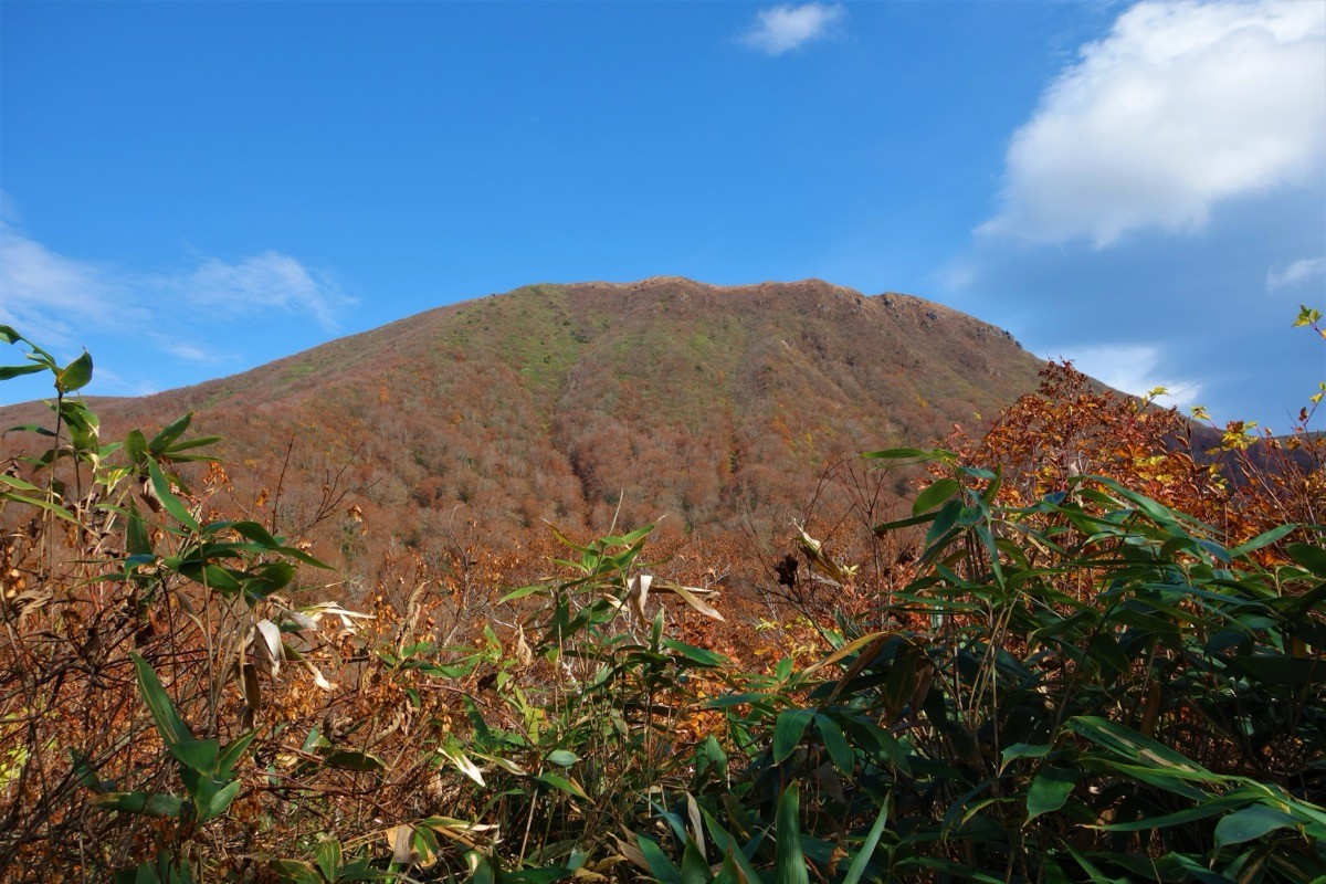
Mt. Funagata (船形山, 1,500 m), on the border of Miyagi and Yamagata, is one of the 200 Famous Japanese Mountains.
Also called Mt. Gosho on the Miyagi side, its appeal lies in the beautiful virgin beech forest spreading across its slopes and the wide view from the summit. An emergency hut stands at the top, looking out over the mountains of Tohoku. With few hazards but long trails, it is a stamina-focused intermediate mountain.
There is no public transport to the trailhead, so a taxi from the nearest town is the norm. The nearest base is Yoshioka in Taiwa (reached by Miyagi Kotsu bus from Sendai Station). You reach the Hatasaka trailhead of the Masuzawa course by taxi from Yoshioka.
The trailhead is the Hatasaka campsite on the Masuzawa course (about 553 m). The standard route is an out-and-back: Hatasaka campsite → Sanko-no-miya junction → Masuzawa hut → Mt. Funagata summit (1,500 m), about 4 hours to the top and roughly 8 hours round trip, a long, stamina-focused intermediate course. You climb a long ridge through virgin beech forest, then follow a stream below the summit to the top.
If you stay at the Funagata emergency hut near the summit, you can walk this long course with more margin. The season runs from fresh green to autumn foliage (roughly June to October). In the snow-melt season (until around May) and just after the thaw, the stream section is muddy and slippery, so take care. Always check the latest trail and forest-road conditions in advance.
How to access the trailheads
1. [Round trip] Yoshioka (bus from Sendai Station) → Hatasaka trailhead
The nearest base is Yoshioka in Taiwa. From JR Sendai Station, take a Miyagi Kotsu bus (toward Yoshioka) to Yoshioka-Kammachi. Beyond Yoshioka there is no local bus to the Hatasaka trailhead of the Masuzawa course, so a taxi is the standard option.
To the Hatasaka campsite (trailhead) is about 30 to 40 minutes by taxi from Yoshioka. Beyond the trailhead the road is an unpaved forest road, and no taxis wait at the trailhead and mobile phone reception is poor, so booking both the outbound and return rides in advance is essential. As the round trip is a long 8 hours, allow margin in the descent time you give for the pickup.
– Yoshioka Taxi (Taiwa) 022-345-2361
Inquiries / overnight stay: For trail and forest-road conditions, check with the Taiwa Town Industry Promotion Division (022-345-1184). For a night before, lodgings around Yoshioka are convenient. If you drive, there is a large car park at the Hatasaka campsite (courses other than Masuzawa, such as Otaki, use unpaved forest roads).
Source: [Taiwa Town, Funagata Masuzawa course] / [Miyagi Marugoto Tanbo, Mt. Funagata]
Route and safety notes
Route: Hatasaka campsite → Hitomure-daira → Sanko-no-miya junction → Kameishi-zawa → Masuzawa hut → Mt. Funagata summit (1,500 m), out and back. It is about 7.6 km one way, about 4 hours to the top, and roughly 8 hours round trip. There are few hazards, but it is long and stamina-focused, intermediate level. There are emergency huts at the summit and at Masuzawa.
Snow and stream notes: Mt. Funagata holds a lot of snow, and snow remains until around May, with the Masuzawa stream section muddy and slippery just after the thaw. Take care on the stream section in high water.
Forest road and access: Courses other than Masuzawa (such as Otaki) run on unpaved forest roads and can be impassable after heavy rain or in the snow season. Check the weather and road conditions not only for the day but for the preceding several days.
Gear and season: The season runs June to October. For the long route, carry water, food, rain gear, warm clothing, a headlamp, and a map/GPS.
Emergencies: In case of accident or distress, call 110 (police) or 119 (fire/rescue).
・Taiwa Town Office 022-345-1111
Photo by Koda6029 / Wikimedia Commons, CC BY-SA 4.0
Comments