Mount Nagi (Nagisan, 1,255 m) sits on the border of Nagi Town in Okayama and Chizu Town in Tottori, and is one of Japan’s 300 Famous Mountains.
The main peak of the Hyōnosen-Ushiroyama-Nagisan Quasi-National Park, its appeal lies in the 360-degree panorama from the summit, the Jabuchi Falls and primeval forest at the trailhead, and the well-maintained A–C courses. The usual day hike reaches the trailhead by bus and taxi from Tsuyama Station and goes up to the summit and back.
For public-transport access, take a Chutetsu Hokubu bus and a taxi from JR Tsuyama Station to the Mount Nagi B/C-course trailhead.
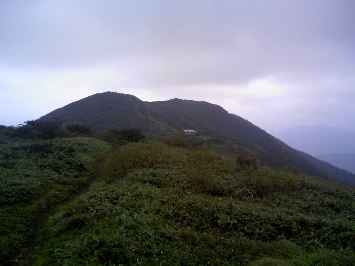
The trailhead is the Mount Nagi B/C-course trailhead (Jabuchi Falls, about 530 m), with free parking and toilets. The main route is B/C-course trailhead → C-course (or B-course) → Mount Nagi (1,255 m) as a circuit, an intermediate route with a standard time of about 4–5 hours. The summit has a 360-degree view, with an emergency hut and toilets nearby.
The best season is spring to late autumn (April–November); there is snow in winter. Always check the latest trail and bus times and arrange a taxi before you go.
*Last checked: June 6, 2026
How to access the trailheads
1. [There & Back] Tsuyama Station ⇄ the Mount Nagi trailhead (Chutetsu Hokubu bus & taxi)
Tsuyama Station on the JR Tsuyama and Kishin lines is your base. Take a bus from the station to near the trailhead, then walk or take a taxi the rest of the way.
① Tsuyama Station → Takamaru bus stop (Chutetsu Hokubu bus)
From Tsuyama Station and Tsuyama Bus Center, take a Chutetsu Hokubu bus bound for Namekata or Makuwa and get off at Takamaru. The ride takes about 40 minutes. As services are infrequent, always check the latest times.
② Takamaru bus stop → Mount Nagi B/C-course trailhead (on foot or by taxi)
From Takamaru it is about 3 km to the trailhead (Jabuchi Falls), around 45 minutes on foot. To save the walk, combining a taxi is reliable.
③ Taxi
As buses are limited, a direct taxi from Tsuyama Station to the trailhead (about 40 minutes) is also convenient.
— Katsuta Kotsu (taxi) 0868-22-1234
④ Return: it is reassuring to book a taxi for your expected descent time. Afterwards return to Takamaru bus stop or Tsuyama Station.
By car: there is free parking at the B/C-course trailhead and the A-course trailhead.
References: [Nagi Town: Jabuchi Falls] / [Okayama Tourism: Mount Nagi]
Trail Guide and Safety Notes
Route: B/C-course trailhead → C-course (ridge) and B-course (along the stream) as a circuit to Mount Nagi (1,255 m). The standard time is about 4–5 hours, an intermediate route. There is also an A-course (on the Jabuchi Falls side), and a circuit using different courses for the climb and descent is popular. The summit has a 360-degree view, with an emergency hut and toilets just below the summit.
Stream and route-finding: the B-course follows a stream and gets high and slippery after rain. Follow the signs and take care not to mistake your descent route at the junctions of the several courses.
Views and seasons: the summit gives a 360-degree view of the Chūgoku Mountains and toward the Sea of Japan. Fresh greenery in spring, enkianthus in early summer and autumn colours are lovely, and there is snow in winter when snow gear is needed.
Equipment and emergencies: carry rain gear, warm clothing, a headlamp, a map/GPS and plenty of food and water. In an accident or emergency call 110 (police) or 119 (fire/ambulance).
・Tsuyama Police Station 0868-23-0110
Photo by Mass Ave 975 / Wikimedia Commons, CC BY-SA 3.0


Comments