Mount Dōgo (Dōgoyama, 1,268 m) sits on the border of Shōbara City in Hiroshima and Nichinan Town in Tottori, and is one of Japan’s 300 Famous Mountains.
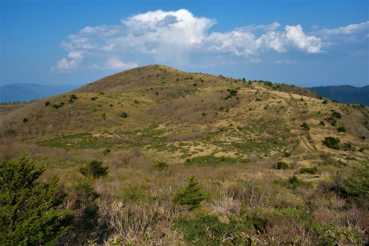
A grassland mountain within the Hiba-Dōgo-Taishaku Quasi-National Park, its appeal lies in the gentle summit spread with cattle pasture and the 360-degree view of the Hiba range, Mount Daisen and the Sea of Japan. The out-and-back from the Tsukimigaoka trailhead over Iwahiyama to Mount Dōgo is an easy, roughly 3-hour course.
Public transport to the trailhead is limited, so you reach it by combining a taxi from Bingo-Ochiai Station on the JR Geibi Line.
The trailhead is Tsukimigaoka (about 1,070 m), with parking, toilets and a campground. The main route is Tsukimigaoka → Iwahiyama (1,271 m) → Mount Dōgo (1,268 m) and back, an easy route with a standard time of about 3 hours. The summit is open grassland with no cover, giving wide views of the Hiba range, Mount Daisen and the Sea of Japan.
The best season is spring to autumn (May–October), with wildflowers and autumn colour. As the Geibi Line has very few trains, always check the latest train times and arrange a taxi before you go.
*Last checked: June 7, 2026
How to access the trailheads
1. [There & Back] Bingo-Ochiai Station ⇄ Tsukimigaoka trailhead (Geibi Line + taxi)
Bingo-Ochiai Station on the JR Geibi Line is your base. There is no direct bus to the Tsukimigaoka trailhead, so take a taxi from the station.
① Bingo-Ochiai Station → Tsukimigaoka trailhead (taxi)
From Hiroshima Station, take the JR Geibi Line to Miyoshi Station, change to a Bingo-Ochiai train and get off at Bingo-Ochiai. The Geibi Line (Miyoshi–Bingo-Ochiai) has only a few trains a day, so check the times in advance. From Bingo-Ochiai Station, take a taxi to the Tsukimigaoka trailhead.
— Dōgo Taxi, Ochiai office 0824-84-2152.
② Local bus (for reference): an infrequent local bus runs to about 4 km short of Tsukimigaoka, but it does not reach the trailhead, so a taxi is reliable.
③ Note (Geibi Line): the Tōjō–Bingo-Ochiai and Bingo-Ochiai–Miyoshi sections are among the most lightly used lines in Japan, with extremely few services, so plan the return train and taxi together.
By car: there is parking at Tsukimigaoka, about 29 km from the Tōjō IC on the Chugoku Expressway.
References: [Shōbara Tourism Navi: access] / [Mount Dōgo course (YAMAP)]
Trail Guide and Safety Notes
Route: the main route is an out-and-back from Tsukimigaoka over Iwahiyama (1,271 m) to Mount Dōgo (1,268 m), an easy route with a standard time of about 3 hours. There is also a path around Ōike pond, and a path skirting Iwahiyama reduces the climbing. It is gentle, but the grassland is fully exposed to wind and rain.
Grassland and weather: the summit is treeless grassland, exposed to strong wind, mist and lightning, so take care in bad weather. In winter there is snow and ice, and the summer trail changes completely.
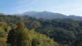
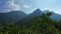
Views and nature: from the summit there is a panorama of the Hiba range, Mount Daisen and the Sea of Japan. The area is cattle pasture and a treasury of wildflowers, with mountain azalea and Japanese chestnut colouring the seasons and fine autumn foliage.
Equipment and emergencies: carry rain gear, warm clothing, a headlamp, a map/GPS, plenty of food and water. In an accident or emergency call 110 (police) or 119 (fire/ambulance).
・Shōbara Police Station 0824-72-0110
Photo by Koda6029 / Wikimedia Commons, CC BY-SA 4.0
Comments