Contents

Mt. Kentoku

2,031m · Yamanashi

Fitness 3 · ModerateDay tripTimetable checked 2026/05/30
Elevation2,031m
Fitness3/10
Walking7:14
Ascent1,200m
Mt. Kentoku2,031 mYamanashi
🚃 Reachable by public transport · Day trip · Intermediate · for reasonably fit hikers
Intermediate
Stamina3/10
TechnicalC rocky sections / chains Official
Trail time 7h 14mestimatedDistance 10.26 kmmeasuredTotal ascent ↑1,200 mmeasuredHighest point 2,022 m
📍 Distance, ascent and trail time are for the route shown on the map.
Access ease Moderate First bus reaches trailhead by 9:02, No transfers, Seasonal access
Gateway station Enzan Station, Yamanashishi Station  →  Trailhead Kandatsuyama Trailhead
1 public-transport routes ・ Station→trailhead approx. 32 min ・ One way ¥810
🌸 Best season: May, Nov bk🏠 Mountain huts, Water source, Toilets, Hot spring nearby
“bk” = data from books (being replaced with our own measurements). Distance, ascent and trail time are measured/estimated from the map route.

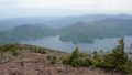
Mt. Kentoku (乾徳山) is a 2,031m peak in Yamanashi Prefecture. From the trailhead, as elevation rises, the scenery changes from forest belt to grassland to rocky ridge; the chain section at Hoiwa just below the summit offers thrilling rock-climbing with a strong sense of exposure, and the sense of achievement is exceptional. From the summit, views of Mt. Fuji and the Southern Alps unfold.
From Enzan Station or Yamanashi-shi Station on the JR Chuo Main Line, access the Mt. Kentoku Trailhead by local bus. One of the 100 Famous Mountains of Yamanashi.


*Timetable last checked: May 30, 2026

How to access the trailheads

  1. [Outbound] Enzan Station → Mt. Kentoku Trailhead
  2. [Outbound] Yamanashi-shi Station → Mt. Kentoku Trailhead
  3. [Return] Mt. Kentoku Trailhead → Enzan Station
  4. [Return] Mt. Kentoku Trailhead → Yamanashi-shi Station

Hiking Course Details — Mt. Kentoku

Click to show current location.
Click for full-screen view.

Map & Recommended Route — Mt. Kentoku

Mt. Kentoku — Reference Hiking Times

Standard pace; times rounded to 5 min
Segment Distance Ascent/Descent Forward Reverse
Kentokusan tozanguchi (乾徳山登山口) → Trailhead (登山道入口) 1.6 km +158 m / −0 m 0:40 0:35
Trailhead (登山道入口) → Kokushi-ga-hara (国師ヶ原) 2.0 km +579 m / −0 m 1:35 1:40
Kokushi-ga-hara (国師ヶ原) → Toilet 0.1 km +11 m / −0 m 0:00 0:00
Toilet → Mt. Kentoku (乾徳山 Kentoku-san) 1.4 km +441 m / −0 m 1:15 1:15
Mt. Kentoku (乾徳山 Kentoku-san) → Ogi daira (扇平) 0.4 km +0 m / −170 m 0:30 0:30
Ogi daira (扇平) → Tsukimi-iwa Rock (月見岩) 0.4 km +0 m / −110 m 0:15 0:20
Tsukimi-iwa Rock (月見岩) → Shado deai (車道出合) 1.4 km +0 m / −223 m 0:40 0:50
Shado deai (車道出合) → Mt. Doman (道満山 Doman-yama) 1.0 km +10 m / −219 m 0:45 0:40
Mt. Doman (道満山 Doman-yama) → Kentokusan tozanguchi (乾徳山登山口) 1.9 km +0 m / −480 m 1:20 1:20
Total 10.3 km +1200 m / −1201 m 7:15 7:15

1. [Outbound] Enzan Station → Mt. Kentoku Trailhead

From JR Chuo Line Enzan Station, take the Yamanashi Kotsu Bus “Kubodaira / Nishizawa Keikoku Line” and get off at Mt. Kentoku Trailhead.
Travel time: about 32 minutes
Fare: ¥810

Operating period: late April to late November, on Saturdays, Sundays and public holidays (daily during Golden Week, the summer holidays and the autumn-foliage season)
Saturdays, Sundays, and holidays from late April to late November (daily operation during Golden Week, summer holidays, and autumn-foliage season)

Bus TimetableEnzan Station to Mt. Kentoku Trailhead bus stop

Enzan Station Dep. Mt. Kentoku Trailhead Arr.
08:30 09:02
09:05 09:37
13:30 14:02
14:30 15:02

Reference: [Yamanashi Kotsu]

2. [Outbound] Yamanashi-shi Station → Mt. Kentoku Trailhead

From JR Chuo Line Yamanashi-shi Station, take the Yamanashi Shimin Bus “Nishizawa Keikoku Line” and get off at Mt. Kentoku Trailhead.
Travel time: about 32 minutes
Fare: ¥400
Operating days: daily (except January 1 and 2)

Bus TimetableYamanashi-shi Station to Mt. Kentoku Trailhead bus stop

Yamanashi-shi Station Dep. Mt. Kentoku Trailhead Arr.
09:12 09:44
10:21 10:53
13:50 14:22
15:17 15:49
17:50 18:22
19:20 19:52

Reference: [Yamanashi Shimin Bus]

3. [Return] Mt. Kentoku Trailhead → Enzan Station

From Mt. Kentoku Trailhead, take the Yamanashi Kotsu Bus “Kubodaira / Nishizawa Keikoku Line” and get off at Enzan Station.
Travel time: about 32 minutes
Fare: ¥810

Operating period: late April to late November, on Saturdays, Sundays and public holidays (daily during Golden Week, the summer holidays and the autumn-foliage season)
Saturdays, Sundays, and holidays from late April to late November (daily operation during Golden Week, summer holidays, and autumn-foliage season)

Bus TimetableMt. Kentoku Trailhead bus stop to Enzan Station

Mt. Kentoku Trailhead Enzan Station
10:03 10:35
13:38 14:10
15:08 15:40
16:08 16:40

Reference: [Yamanashi Kotsu]

4. [Return] Mt. Kentoku Trailhead → Yamanashi-shi Station

From Mt. Kentoku Trailhead, take the Yamanashi Shimin Bus “Nishizawa Keikoku Line” and get off at Yamanashi-shi Station.
Travel time: about 32 minutes
Fare: ¥400

Bus TimetableMt. Kentoku Trailhead bus stop to Yamanashi-shi Station

Mt. Kentoku Trailhead Dep. Yamanashi-shi Station Arr.
07:06 07:38
07:46 08:18
10:38 11:10
11:48 12:20
15:36 16:08
16:51 17:23

Reference: [Yamanashi Shimin Bus]

Kentokusan Hiking Routes, Difficulty and Best Season

Kentokusan is a 2,031 m peak in Yamanashi with wonderfully varied terrain, shifting from larch forest to grassland and finally rock. Its trademark is the long chained rock face just below the summit, Hōgan-iwa, and the trail opens out onto views of Mount Fuji and the Southern Alps. This section sums up the main routes, how demanding they are and the best time to climb.

Main routes

  • Loop from Tokuwa (the classic): starting at Tokuwa, the trail passes the Ginshosui and Kinshosui springs, climbs through Ogidaira to the summit and returns as a loop. About 10.3 km, roughly 1,200 m of cumulative ascent and about 7 hours 15 minutes on the trail, technical grade C. A rewarding intermediate-to-advanced route.
  • The chained rock “Hōgan-iwa” below the summit: just under the top is a long, near-vertical chained face known as Hōgan-iwa, the exposed signature of Kentokusan. If you would rather not tackle it, there is a bypass path on the left.

Difficulty and stamina: with its long distance and large cumulative ascent, this is a route for intermediate-to-advanced hikers. The chained section below the summit is exposed and calls for extra care in the rain or when crowded (a bypass exists). The Ginshosui and Kinshosui springs are on the way, but it is wise to carry plenty of water.

Best season: late April to November is the window, and the fresh green of spring and the autumn colours are especially beautiful. The chains become slippery when wet, so move carefully in the rain or just after it.

Highlights: a richly varied trail that shifts from larch forest to the grassland of Ogidaira and the rocky summit area, plus the sweeping view of Mount Fuji and the Southern Alps. The thrill of the trademark Hōgan-iwa chains is part of the appeal too.

Your next mountain

Mt. Kaikomagatake 100 Famous Mountains
IntermediateEasy🚃Tokyo 3h 46Day tripTrail time 6h 427.22 km

The northern sentinel of the southern Alps, nicknamed the Southern Alps Prince for its striking white granite ridgeline.

Mt. Senjōgatake 100 Famous Mountains
IntermediateEasy🚃Tokyo 3h 46Day tripTrail time 7h 00

The Queen of the Southern Alps, a triple-cirque mountain carpeted with alpine flowers and known for its gentle, welcoming profile.

Mt. Mizugaki 100 Famous Mountains
IntermediateModerate🚃Tokyo 2h 58Day tripTrail time 4h 545.36 km

A mountain of extraordinary granite pillars and monoliths, vivid with Shakunage in early summer against views of Yatsugatake and the southern Alps.

Mt. Aino 100 Famous Mountains
IntermediateModerate🚃Tokyo 2h 30OvernightTrail time 15h 5817.55 km

Japan's third-highest summit, offering sweeping ridge views alongside Kitadake in the southern Alps.

Climbed it? Stamp your logbook