Mt. Kohide (小秀山, 1,982 m), on the border of Nakatsugawa (Gifu) and Otaki (Nagano), is one of the 200 Famous Japanese Mountains.
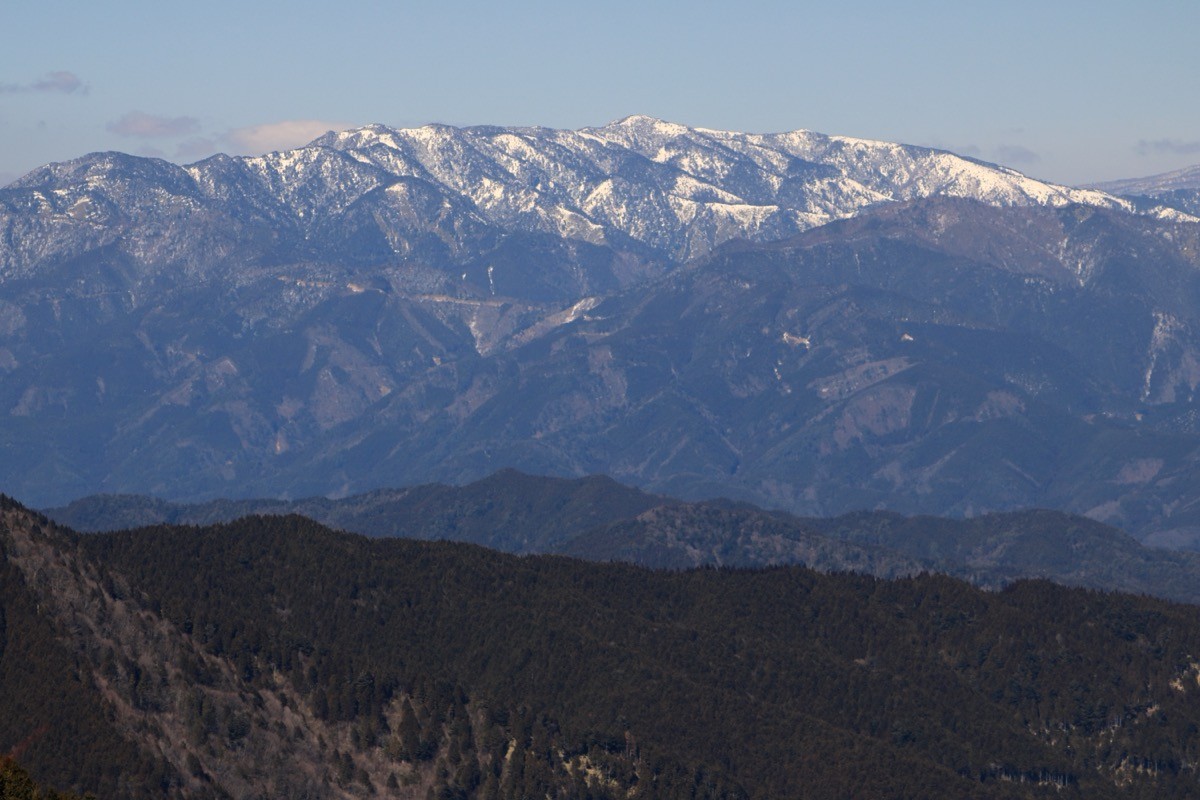
Lying south of Mt. Ontake, its appeal is the grand view of Mt. Ontake from the summit and the waterfalls such as Fufu Falls and Nejire Falls along the Otome Gorge at the trailhead. There is the Ni-no-tani course, which includes the rocky “Kamoshika-watari,” and the easier San-no-tani course; the loop takes about 8 hours, intermediate level.
There is no public transport to the trailhead, so a taxi from the nearest station or a car is the norm. The nearest station is Nakatsugawa on the JR Chuo Main Line. You reach the Otome Gorge campsite trailhead by taxi from Nakatsugawa Station.
The trailhead is the Otome Gorge campsite (Kashimo, Nakatsugawa, Gifu). The standard route is a loop: campsite → Ni-no-tani (waterfalls, Kamoshika-watari) → Mt. Kohide summit → San-no-tani → campsite, with a standard time of about 8 hours over about 11.6 km, intermediate level. Ni-no-tani is a varied path from a waterside promenade over the rocky “Kamoshika-watari,” while San-no-tani is a relatively easy forest route.
Near the summit there is an emergency hut (Shuhosha), a rest point and refuge. The season runs from early summer when the rhododendrons bloom to autumn foliage (roughly May to November). The rocks of Ni-no-tani and Kamoshika-watari are slippery after rain, so take care. Always check the latest trail and forest-road conditions in advance.
How to access the trailheads
1. [Round trip] Nakatsugawa Station → Otome Gorge campsite (trailhead)
The base is Nakatsugawa Station on the JR Chuo Main Line. There is no local bus to the Otome Gorge campsite trailhead, so a taxi or a car is the standard option.
To the Otome Gorge campsite is reached by taxi from Nakatsugawa Station (about 37 km via National Routes 257 and 256). As the distance is long, the fare is high. No taxis wait at the trailhead and mobile phone reception is poor, so booking both the outbound and return rides in advance is essential. As the loop takes about 8 hours, allow margin in the descent time you give for the pickup.
– Kintetsu Tobi Taxi (Nakatsugawa) 0573-66-1221
– Kitaena Kotsu (Nakatsugawa) 0573-66-1555
Forest road / inquiries: For closures of the Otome Gorge promenade or the trail, check in advance with the Kashimo General Office (0573-79-2111). If you drive, there is parking at the Otome Gorge campsite (¥500 per day for a regular car for hiking use).
Source: [Gifu Travel Guide, Otome Gorge] / [Yamatabitabi, Mt. Kohide]
Route and safety notes
Route: Otome Gorge campsite → Ni-no-tani (Fufu Falls, Kamoshika-watari) → Kabuto-iwa → Mt. Kohide (1,982 m) → San-no-tani → campsite, a loop. The standard time is about 8 hours over about 11.6 km, intermediate level. From the summit the grand view of Mt. Ontake opens up, and there is an emergency hut (Shuhosha) near the top.
Rocky section / Kamoshika-watari: The “Kamoshika-watari” on Ni-no-tani is a steep rocky section using chains and rock, slippery and dangerous after rain or in fog. If you are uneasy on rock, take the easier San-no-tani course for both ascent and descent.
Forest road and access: The forest road and promenade to the trailhead can be closed after heavy rain or disasters. Check the weather and access conditions not only for the day but for the preceding several days.
Gear and season: The season runs May to November. Carry water, food, rain gear, warm clothing, a headlamp, and a map/GPS.
Emergencies: In case of accident or distress, call 110 (police) or 119 (fire/rescue).
・Nakatsugawa City Hall 0573-66-1111
Photo by Alpsdake / Wikimedia Commons, CC BY-SA 4.0

Comments