
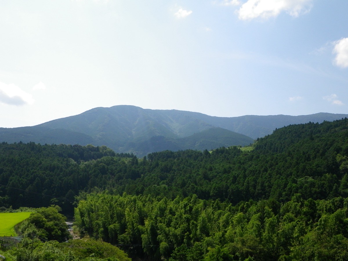
Mount Sasayama (Sasayama, 1,065 m) sits on the border of Sukumo City in Kochi and Ainan Town in Ehime, and is one of Japan’s 300 Famous Mountains.
A mountain of faith with Sasayama Shrine on its summit, its appeal lies in the great colonies of Akebono azalea and rhododendron that colour the slopes from late April to early May. Drive up to the No. 1 parking lot at the eighth station and it is about 40 to 60 minutes to the summit, an easy climb.
There is no direct bus to the trailhead, so you reach it by combining a taxi from Sukumo Station on the Tosa Kuroshio Railway.
The main trailhead is the No. 1 parking lot at the eighth station (the front approach), with toilets. The main route is No. 1 parking lot → Sasayama Shrine → Mount Sasayama (1,065 m) and back, an easy route of about 40 to 60 minutes to the summit. Old-growth forest and colonies of Akebono azalea and rhododendron spread out, and the summit looks over the Uwa Sea and the Pacific.
The best season is spring to autumn (April–November), with the Akebono azalea at its best from late April to early May. The forest road is narrow with rockfall, so always check the latest road conditions and arrange a taxi before you go.
*Last checked: June 7, 2026
How to access the trailheads
1. [There & Back] Sukumo Station ⇄ the No. 1 parking lot (taxi)
Sukumo Station on the Tosa Kuroshio Railway Sukumo Line is your base. There is no direct bus to the Sasayama trailhead, so take a taxi from the station.
① Sukumo Station → No. 1 parking lot (taxi)
From Sukumo Station, via Prefectural Route 4 and the Nango city road, it is about 50 minutes by taxi to the No. 1 parking lot (the front-approach trailhead) at the eighth station. As the mountain forest road is narrow, check when you book that the taxi can reach the trailhead.
— Sukumo Hire 0880-63-2111 / Marusan Kanko Hire 0880-63-0050.
② Back approach (Haraikawa gorge): from Inuyoke in Tsushima on the Ehime side, the back approach via the Haraikawa gorge is a fuller route of about 3 hours 30 minutes, starting from Haraikawa Onsen.
③ Note (forest road and season): the front-approach forest road is narrow with possible rockfall, so take care driving and when booking a taxi. The Akebono-azalea season (late April to early May) is busy.
By car: you can drive up to the No. 1 parking lot (eighth station). Access by forest road from Sukumo on the Kochi side or Ainan on the Ehime side.
References: [Sukumo City: Mount Sasayama] / [Ainan Town: Mount Sasayama]
Trail Guide and Safety Notes
Route: the main route is an out-and-back from the No. 1 parking lot at the eighth station via Sasayama Shrine to the summit (1,065 m), an easy route of about 40 to 60 minutes. For a fuller walk, there is the back approach from the Haraikawa gorge on the Ehime side (about 3 hours 30 minutes). Sasayama Shrine stands just below the summit.
Forest road and weather: the forest road to the front approach is narrow, with rockfall and sections where passing is difficult. The summit area can be socked in by mist, and in winter watch for snow and ice.
Views and nature: from the summit there are views of the Uwa Sea, the Pacific and the mountains of south-western Shikoku. The great colonies of Akebono azalea and rhododendron peak from late April to early May, and you can see the harimomi spruce that in Shikoku grows only on Sasayama.
Equipment and emergencies: carry rain gear, warm clothing, a headlamp, a map/GPS, plenty of food and water. In an accident or emergency call 110 (police) or 119 (fire/ambulance).
・Sukumo Police Station 0880-63-0110
Photo by As6022014 / Wikimedia Commons, Public domain
Comments