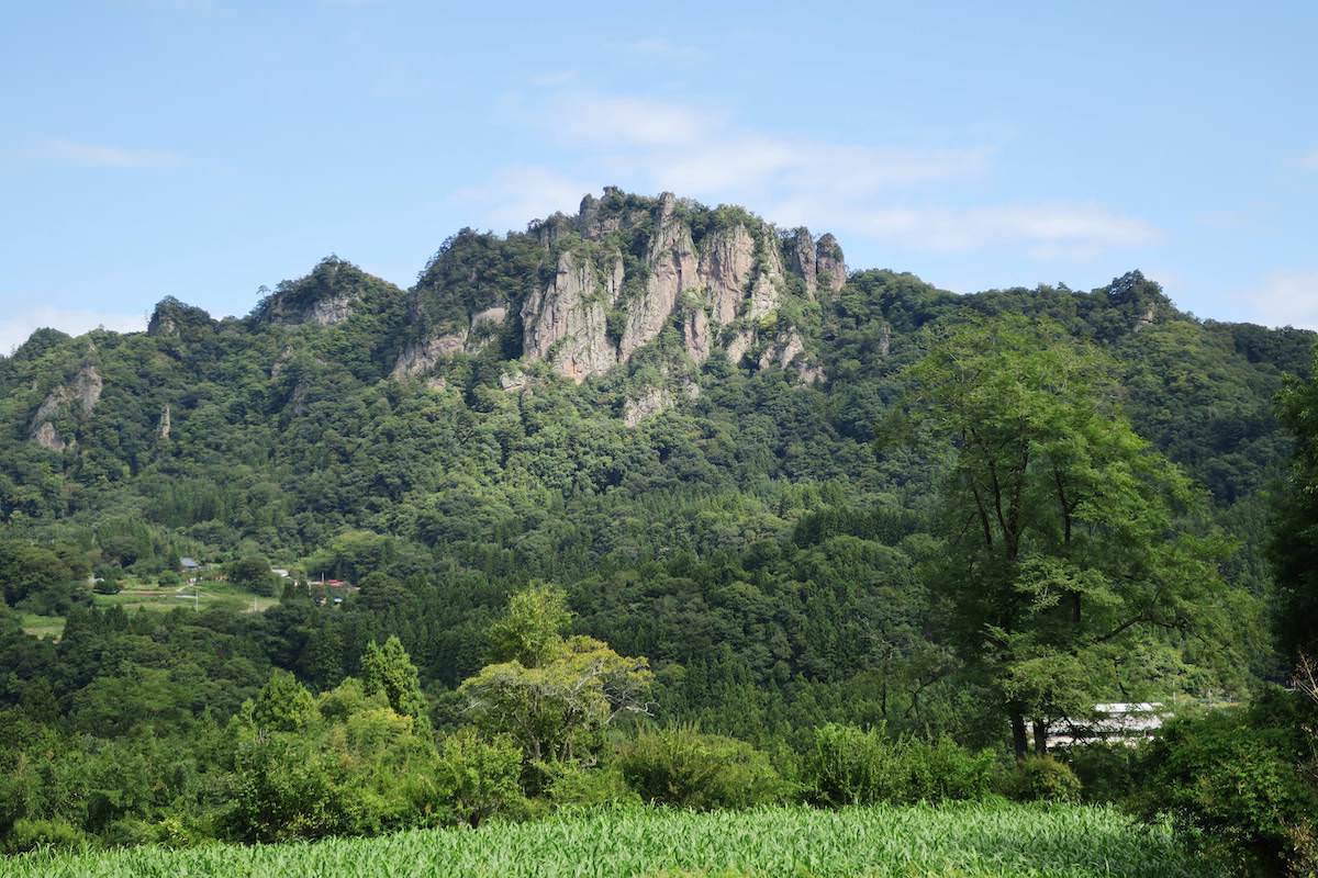
Mt. Iwabitsu (岩櫃山) is a 802.6m rocky peak in Higashiagatsuma Town, Gunma Prefecture. Despite being a low mountain, it features rock faces and chain sections, offering everything from beginner hiking to intermediate-level ridge walking depending on route choice. The mountain has well-maintained trails including the “Ridge Route” and “Valley Route” (from Hirasawa trailhead) and the “Mitsuiwa Route” and “Akaiwa Route” (from Gohara/Furuya side), with good signage and official maps. The Mitsuiwa Route in particular involves consecutive chains and ladders, suited for intermediate hikers. Helmets and gloves are recommended, and extra caution is needed on wet rock. The “Tengu-no-Kakehashi” (天狗の架け橋) section may require a detour depending on conditions.
Some trails differ from those shown on Geographical Survey Institute maps.
The Iwabitsuyama Area Guide (岩櫃山周辺ガイド) published by Higashiagatsuma Town is a helpful reference.
Access
- Getting There: Gohara Station → Mitsuiwa Trailhead
- Return: Hirasawa Trailhead → Gunma-Haramachi Station
Map
1. Getting There: Gohara Station (郷原駅) → Mitsuiwa Trailhead (密岩登山口)
From JR Agatsuma Line Gohara Station (郷原駅), it is about a 25-minute walk (1.6km) to the Mitsuiwa Trailhead (密岩登山口).
Follow the prefectural road and trail signs from the station to reach the trailhead. The Mitsuiwa Route features consecutive chains and ladders on a rocky ridge — in wet, icy, or windy conditions, switching to the Hirasawa trailhead routes (Ridge/Valley) is recommended for safety.
Reference: [Google Map]
2. Return: Hirasawa Trailhead (平沢登山口) → Gunma-Haramachi Station (群馬原町駅)
From the summit, descend via the “Valley Route” (沢通り) to Hirasawa Trailhead (about 40 min). From Hirasawa Trailhead, it is approximately a 30-minute walk to JR Agatsuma Line Gunma-Haramachi Station (群馬原町駅). Start from the Hirasawa Trailhead Tourist Information Center (open on certain days; restrooms and pamphlets available) and follow the paved road downhill.
Reference: [Google Map]

