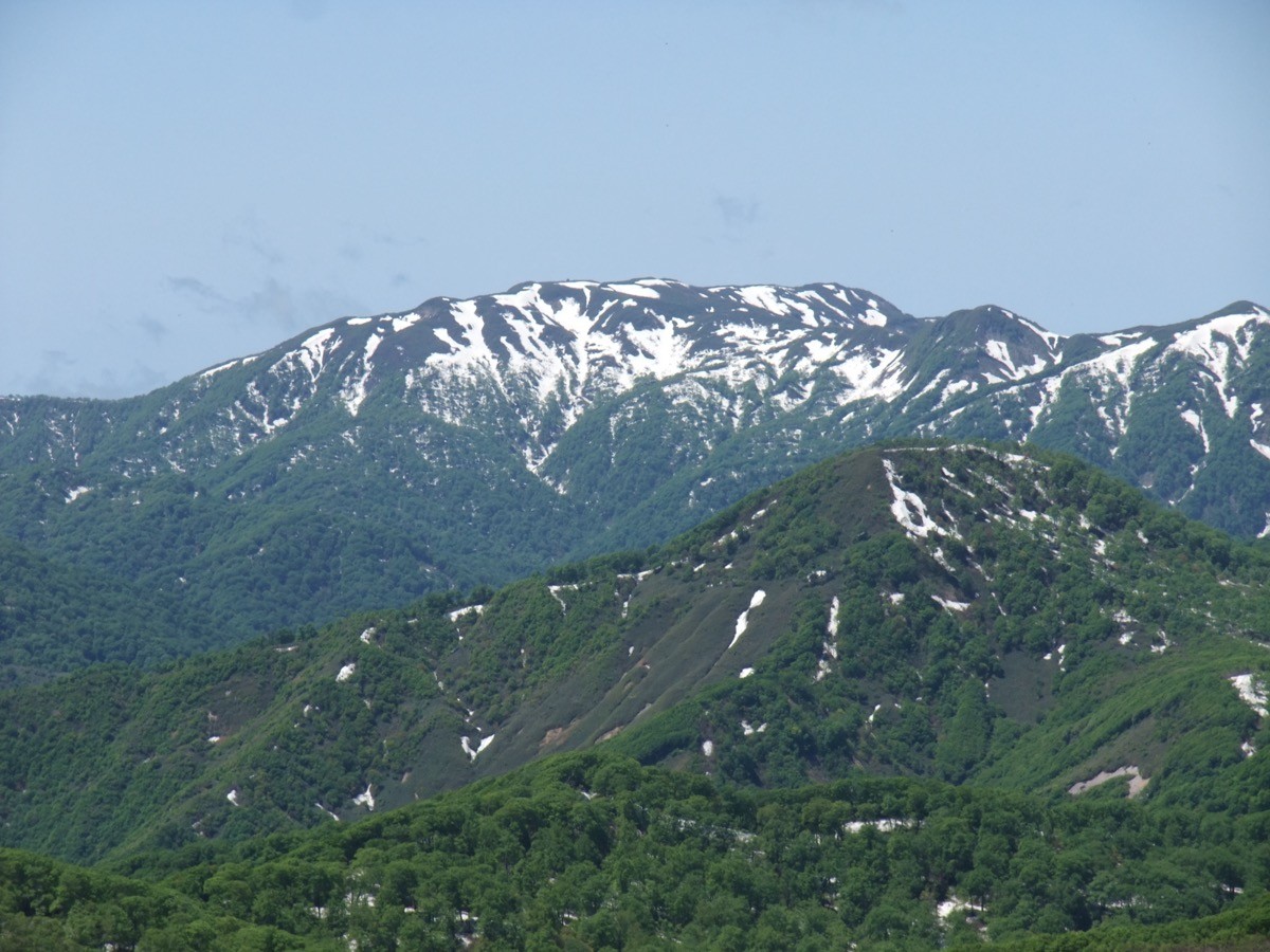
Mt. Shirakami (白神岳, 1,235 m) in Fukaura, Aomori Prefecture, is one of the 200 Famous Japanese Mountains.
It is the highest peak of the Shirakami-Sanchi World Natural Heritage area, known for its primeval beech forest. The usual route, out and back from the summit via the Mateyama course, is about 13 km round trip with 1,140 m of ascent and around 8 hours of walking — an intermediate course — and the Shirakami-dake emergency hut stands just below the summit.
The nearest station is Shirakami-dake-tozanguchi on the JR Gonō Line. Given the long day, staying overnight near Fukaura or Jūniko is the realistic option.
The trailhead is the Shirakami-dake trailhead (about 200 m elevation), with parking for 70 cars, a rest building and toilets. The Mateyama course runs trailhead → Futamata junction → Mateyama → Ōmine junction → summit (1,235 m), about 8 hours round trip. The steep climb to Mateyama is the physical crux; beyond the Ōmine junction the ridge opens into beech forest and views worthy of the World Heritage area. An emergency hut with a toilet stands just below the summit.
The season is late May to early November. The core zone of the World Natural Heritage is closed to entry, but the Mateyama course trail is walkable as usual. As it is a long 8-hour day with early sunset, plan on an early start.
From Shirakami-dake-tozanguchi Station the trailhead is about 1.8 km — 40–50 min on foot or about 10 min by taxi.
How to access the trailhead
1. [Outbound & Return] Shirakami-dake-tozanguchi Station → Shirakami-dake trailhead
Get off at Shirakami-dake-tozanguchi Station on the JR Gonō Line. From the station the trailhead is about 1.8 km — 40–50 min on foot, or about 10 min by taxi.
The Gonō Line has only a few local trains a day, and the “Resort Shirakami” sightseeing train does not stop at Shirakami-dake-tozanguchi (it stops at Jūniko and other stations). As the hike runs about 8 hours, the realistic plan is to stay overnight near Fukaura or Jūniko and head to the trailhead by an early train or by taxi. Always check exact train times on the official JR East timetable.
Booking the taxi in advance is recommended, and you can arrange a pick-up to match your descent time.
– Fukaura Taxi 0173-74-2521
Source: [JR East, Gonō Line] / [Yamakei Online, Shirakami-dake trailhead]
Route and safety notes
Route: Shirakami-dake trailhead → Futamata junction → Mateyama → Ōmine junction → summit. About 13 km round trip, 1,140 m of ascent, around 8 hours of walking, intermediate. The steep climb to Mateyama is the physical crux; on the ridge, beech forest and views over the Sea of Japan open up. An emergency hut (with toilet) stands just below the summit.
For the long day: at about 8 hours round trip with limited escape routes, start early, allow ample time, and carry a headlamp and plenty of water and food; if needed, consider using the emergency hut. There are no shops on the mountain.
World Heritage rules: the core zone of the Shirakami-Sanchi is closed to entry, so keep to the designated Mateyama course. The season is late May to early November; in the lingering-snow season or bad weather, check trail conditions in advance.
Bears and equipment: Asian black bears live in the area, so carry a bear bell and submit a climbing plan.
In an emergency: call 110 (police) or 119 (fire/rescue).
・Fukaura Taxi (pick-up / descent contact) 0173-74-2521
Photo by らんで / Wikimedia Commons, CC BY-SA 3.0
Comments