Mt. Miune (三嶺, 1,894 m), on the border of Kami in Kochi and Miyoshi in Tokushima, is one of the 200 Famous Japanese Mountains.
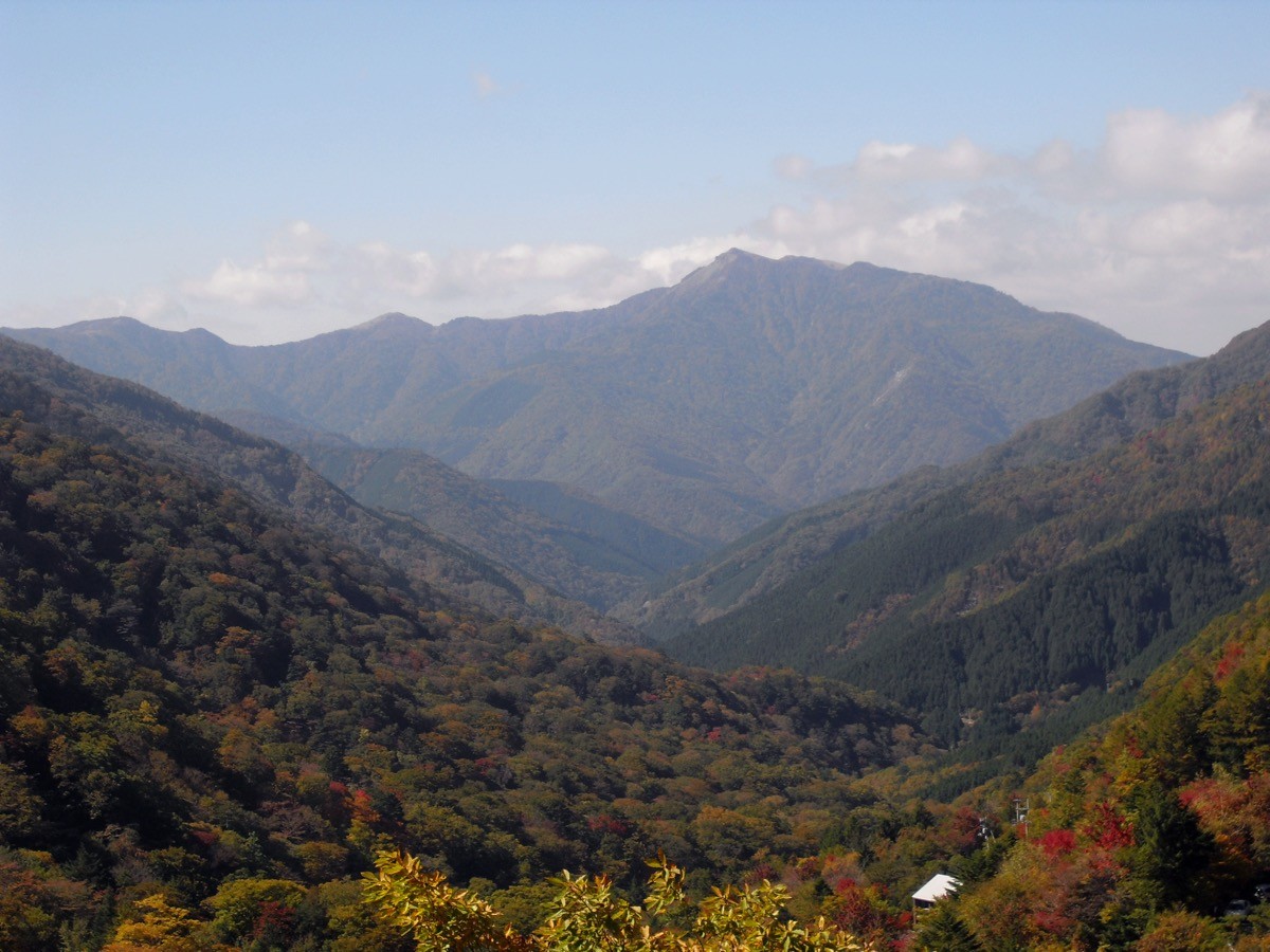
On the spine of the Shikoku Mountains, its appeal is the dwarf-bamboo meadow and pond around the summit, the open ridge running toward Mt. Tsurugi, and the Komet-tsutsuji azaleas in summer. It is usually climbed from Nagoro on the Tokushima side, and the classic plan is a day trip out and back to Mt. Miune from the Nagoro trailhead.
For public transport to the trailhead, take a Shikoku Kotsu bus and a Miyoshi City bus from JR Awa-Ikeda Station to Nagoro.
The trailhead is Nagoro (about 900 m), with a free car park (about 50 cars) and a toilet. The standard route is Nagoro trailhead → Dakemomi-no-oka → Mt. Miune, out and back, with a standard time of about 5–6 hours, an intermediate route. Just below the summit there is a pond and the Miune Hut emergency shelter, and from the summit the grand view of the bamboo meadows running toward Mt. Tsurugi and Tengu-zuka opens up.
The best season is spring to autumn (roughly May to November); the summit meadow can be hard to navigate in fog, so beware of sudden weather changes. Always check the latest trail, forest-road and bus conditions in advance.
*Last checked: June 6, 2026
How to access the trailheads
1. [Round trip] Awa-Ikeda Station → Kubo → Nagoro (trailhead)
The base is Awa-Ikeda Station on the JR Tokushima Line. To Nagoro you change buses twice.
① Awa-Ikeda Station → Kubo (Shikoku Kotsu bus)
Take the Shikoku Kotsu bus “for Kubo” from Awa-Ikeda Station and get off at Kubo. It takes about 1 hour 50 minutes, with four services a day.
② Kubo → Nagoro (Miyoshi City bus)
At Kubo, change to a Miyoshi City bus and get off at Nagoro, about 15 minutes, with two services a day, arriving at Nagoro around 10:33 and 13:43. As there are few services and a transfer is involved, always confirm the latest times with Shikoku Kotsu and the Miyoshi City bus.
③ Taxi
As services are few, using a taxi straight to the trailhead is also reliable.
― Miune Taxi 0883-88-2420
― Miyoshi City Bus (inquiries) 0883-88-2212
By car: There is a free car park (about 50 cars) at the Nagoro trailhead.
Source: [Shikoku Kotsu] / [Yamakei Online, Nagoro trailhead]
Route and safety notes
Route: Nagoro trailhead → Dakemomi-no-oka → Miune Hut → Mt. Miune (1,894 m), out and back. The standard time is about 5–6 hours, an intermediate route. From the summit the grand view of the Shikoku Mountains toward Mt. Tsurugi, Jiro-gyu and Tengu-zuka opens up.
Meadow and route-finding: The dwarf-bamboo meadow around the summit can be hard to follow in fog. On days of poor visibility, check your position often with a map and GPS, and do not overdo it.
Emergency hut, water and season: Just below the summit there is the Miune Hut emergency shelter (for emergencies). As reliable water sources are few, carry plenty of water. The best season is May to November.
Gear and emergencies: Carry rain gear, warm clothing, a headlamp, a map/GPS and ample food. In an accident or emergency, call 110 (police) or 119 (fire/rescue).
・Miyoshi Police Station 0883-72-0110
Photo by As6022014 / Wikimedia Commons, CC BY-SA 3.0
Comments