Mount Ōgi (Ōginosen) is a 1,310 m peak on the border of Tottori City and Yazu District in Tottori Prefecture and Shin-Onsen Town in Mikata District, Hyogo Prefecture, and is one of the 300 Famous Mountains of Japan.
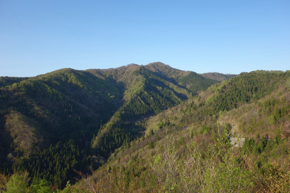
Rivaling Mount Daisen as one of Tottori’s finest peaks, it is a shield volcano spreading gentle slopes in all directions. From the summit you enjoy a sweeping view stretching to Mount Hyōno, the Tottori Sand Dunes and the Sea of Japan, along with the natural charm of beech forest and highland scenery. You can climb it via an easy, walkable beginner route taking about one hour one way from the Kawaitani Highland trailhead to the summit.
Because there is no public transport to the Kawaitani trailhead, you take a taxi from JR Tottori Station to the Kawaitani trailhead.
The trailhead is the Kawaitani trailhead (Mizu-to-Fureai-no-Hiroba / Water Contact Plaza, about 900 m elevation), with parking space for about 10 cars. The main route is the round trip Kawaitani trailhead → China Nature Trail → Mount Ōgi (1,310 m), an easy beginner route with a standard course time of about 2 to 2.5 hours. At the summit stands a two-story emergency hut built in 1994, and from its top floor open views of Mount Hyōno and the Sea of Japan spread out.
The best season is May to November. In winter it becomes one of western Japan’s leading ski-touring mountains, and the forest road is closed during the cold season. The Kawaitani forest road may be closed during snowy periods or after heavy rain, so always check the latest road conditions in advance.
*Last checked: June 10, 2026
How to access the trailheads
1. [Round trip] Tottori Station ⇄ Kawaitani trailhead (taxi)
Tottori Station on the JR San’in Main Line is the base. There is no route bus heading to the Kawaitani trailhead, so you use a taxi from the station.
① Tottori Station → Kawaitani trailhead (taxi)
From Tottori Station, it is about 23 km and about 40 minutes by taxi via Tottori Prefectural Route 31 and the Kawaitani forest road to the Kawaitani trailhead (Water Contact Plaza). As the route includes a forest-road section, confirm when booking whether the taxi can go all the way to the trailhead.
― Hinomaru Hire, Tottori Office, 0857-22-2121.
② Checking the Kawaitani forest road: The Kawaitani Wide-Area Trunk Forest Road leading to the Kawaitani trailhead has winter closures and closures after heavy rain, so check the latest road conditions in advance.
― Tottori City Kokufu-cho General Branch Office, Industry and Construction Division, 0857-30-8656.
③ Other trailheads (for reference): From the Himeji trailhead and Furusato-no-Mori trailhead on the Hyogo side, and the Hatagahira trailhead on the Tottori side, you can also reach the summit in about 1 hour 30 minutes, but none have public transport and all assume a car or taxi.
Private car: The Water Contact Plaza at the Kawaitani trailhead has parking space (about 10 cars). It is about one hour from Tottori IC on the Tottori Expressway.
Reference: [Tottori Prefecture: The Road to Mount Ōgi] / [Kawaitani trailhead (Yamakei Online)]
Trail Guide and Safety Notes
Course: Round trip Kawaitani trailhead (Water Contact Plaza) → China Nature Trail → Daizukko → Mount Ōgi (1,310 m). The standard course time is about 2 to 2.5 hours, an beginner route. The well-maintained beech-forest path includes boardwalk near the summit and is walkable even for families.
Forest road and weather notes: The Kawaitani forest road has unpaved sections, winter closures and closures after heavy rain. The summit area is windy and visibility can worsen in fog, so follow the signs as you proceed.
Views and seasons: From the upper floor of the summit emergency hut there are views of Mount Hyōno, the Tottori Sand Dunes and the Sea of Japan. The fresh greenery and autumn foliage are beautiful, and the silver-grass grasslands across the highland are also a highlight. In winter there is snowfall, and it is known as a ski-touring mountain.
Gear and emergencies: Carry rainwear, warm clothing, a headlamp, a map/GPS, ample trail food and drinking water. In case of distress or accident, call 110 (police) or 119 (fire/ambulance).
・Tottori Police Station 0857-23-0110
Photo by Koda6029 / Wikimedia Commons, CC BY-SA 4.0

Comments